Showing posts with label dam. Show all posts
Showing posts with label dam. Show all posts
Monday, May 16, 2022
Hines Pond & Dam | Tracy City, TN | SeeMidTN.com Presents
Hines Pond is a nearly forgotten roadside stop along U.S. Highway 41 in Tracy City, Grundy County, TN. The pond is formed by a dam on Fiery Gizzard Creek atop the South Cumberland Plateau.

Thursday, October 7, 2021
Elk River Dam

The Elk River Dam is part of the Arnold Engineering Development Center near Tullahoma in Franklin County, TN. The United States Air Force constructed the Elk River Dam in 1952 creating Woods Reservoir as a source of cooling water for processes at the AEDC.
Getting here was a little tricky as the area is no longer maintained and the road here is closed. from Highway 279, if you take Elk River Dam Rd. to a gravel parking lot, it's a 1/4 mile walk to the bottom. Don't confuse this with the Tims Ford Dam also on the Elk River but on the other side of Winchester.
Thursday, September 30, 2021
Lillard's Mill Hydroelectric Station
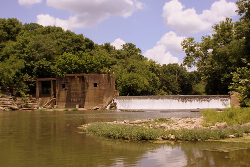
This historic mill on the Duck River is in rural Marshall County, TN and the unincorporated community that was built nearby was known as Milltown. This dam was completed in 1928 and is historically significant as one of three dams on the Duck River to predate TVA. You can read it's entry on the National Register of Historic Places here: npgallery.nps.gov/AssetDetail/NRIS/89002370
Today, the area is considered a park and popular with the locals. To get here, follow there is a gravel driveway that leads off of Milltown Rd. This driveway leads to a parking lot, and you can then walk the gravel to the Duck River. This is a calm spot in the river 1000 ft past the dam, and it is popular for swimming and rafting. To the east, you can walk along the rocky terrain to get a closer view of the dam. If you take a close look, there are some adventurous teens that have climbed onto it.
Thursday, August 12, 2021
Columbia Hydroelectric Station

The construction of the hydroelectric station was completed in 1925. It was designed by Freeland, Roberts and Co. and built by Foster & Creighton for the Southern Cities Corporation. It is one of the remaining hydroelectric stations in Tennessee that predates the TVA. It has been listed on the National Register of Historic Places since February 9, 1990. This view of the dam and the Duck River is easily accessible from Riverwalk Park.
focus.nps.gov/AssetDetail/NRIS/89002364
Saturday, July 3, 2021
Video: Dam on the Stones River
This dam is all which remains of a mill along the middle fork of the Stones River on the south side of Rutherford County.
Sunday, April 11, 2021
Smyrna, TN - Gregory Mill Park - Stewarts Creek
Gregory Mill Park in Smyrna, TN is based around a mill and dam on Stewarts Creek. The Mill is long gone, but the dam remains.
Sunday, January 17, 2021
Walker Mill Hydroelectric Station - Sevierville, TN
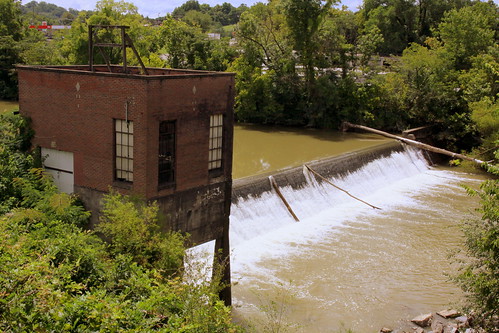
I might be the only person who would go to the Gatlinburg/Pigeon Forge area and look for a century old spillway.
This dam in Sevierville is on the National Register of Historic Places. Here is the text from its 1990 NRHP nomination form:
The Walker Mill Hydroelectric Station is located in Sevier County (population 41,418) on the West Prong of the Little Pigeon River at mile 2.5, and just off U.S. Highway 441.
The dam is a concrete gravity structure approximately 227 feet long and eleven and five-tenths (11.5) feet high. It features an uncontrolled spillway section 115 feet in length.
The steel reinforced concrete powerhouse substructure and brick powerhouse measures forty (40) feet by twenty (20) feet and is located on the dam approximately fifty (50) feet from the right abutment. One tapered concrete pillar extends from the river helping supporting the powerhouse's northwest corner. The intake is an opening in the powerhouse headwall which is controlled by two gates. The water conductor is a simple open flume.
The Walker Mill Hydroelectric Station is significant under National Register criterion C for engineering because it represents the kind of hydroelectric engineering projects typical at the time of its construction on the smaller rivers of the State of Tennessee. Its design, while not unique among its class in the Volunteer State, displays the typical vertical emphasis of what can be called "early hydro-style." It, along with another now demolished site, provided the electric needs of the town of Sevierville until 1938 when the TVA acquired the station. It is capable of operation today when the water level is high enough.
The Walker Mill Hydroelectric Station is likewise significant under National Register criterion A, as it represents a change in the business of trading, commerce, services and commodities, and the gradual introduction of electricity into everyday human existence during the early twentieth century in Tennessee.
Initial interest in a hydroelectric facility was expressed in Sevierville in 1912. On October 28, 1914, the concrete dam was finished, and by November of that year the facility began generating electricity. Local competition flourished and soon there were two hydroelectric stations on the West Prong of Pigeon Forge River, one at the Newport Milling Company site, the other at the Walker Mill site. By 1938 the TVA had purchased both sites and by 1940 sold them back to city of Sevierville which would buy its power from TVA and extend its own system to local rural areas. Only the Walker Mill site is extant and occasionally in operation when the river level is adequately high.
Friday, November 6, 2020
Douglas Dam - Sevier County, TN
en.wikipedia.org/wiki/Douglas_Dam
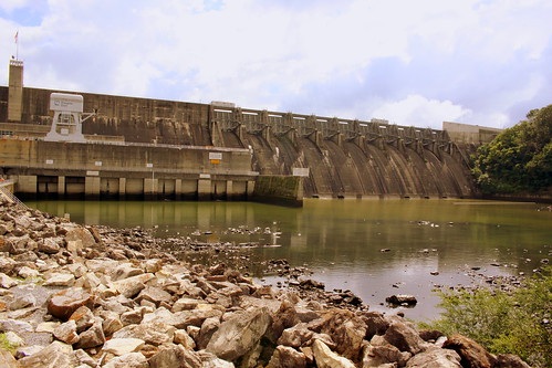
Douglas Dam is a hydroelectric dam on the French Broad River in Sevier County, TN. The dam is operated by the Tennessee Valley Authority (TVA), which built the dam in record time in the early 1940s to meet emergency energy demands at the height of World War II. Douglas Dam is a straight reinforced concrete gravity-type dam 1705 feet long and 202 feet high, impounding the 28,420-acre Douglas Lake. The dam was named for Douglas Bluff, a cliff overlooking the dam site prior to construction.
Monday, September 4, 2017
Tater Knob Scenic Overlook
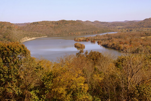
Happy Labor Day! Here's a scenic overlook that you can visit today.
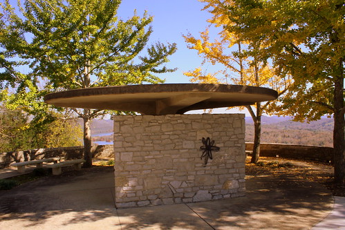
Tater Knob is a mountain in Smith County. At the top is an observation deck which provides a scenic overlook of Cordell Hull Lake and Dam.


According to Wikipedia:
Cordell Hull Lake is a lake in the Cumberland River in north-central Tennessee, about forty miles east of Nashville, in the vicinity of Carthage. It covers approximately 12,000 acres.
Cordell Hull Dam impounding the Cumberland River was built by the United States Army Corps of Engineers between May 1963 and November 1973 for navigation, hydroelectric power generation, and recreation. The dam is concrete and earthen gravity structure, 87 feet high (above streambed), with a generator capacity of 100 megawatts. It impounds 259,100 acre feet at normal maximum pool, with a maximum flood storage of 310,900 acre feet.
Both are named for Cordell Hull, former United States Secretary of State.
Tuesday, August 22, 2017
Cheatham Lock & Dam
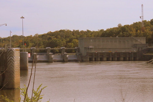
Cheatham Lock & Dam is downstream from Ashland City along the Cumberland River in Cheatham County.
From the US Army Corps of Engineers website:
www.lrn.usace.army.mil/Locations/NavigationLocks/Cumberla...
Cheatham Lock is located at Mile 148.6 on the Cumberland River in Cheatham County, Tennessee and is approximately 10 miles northwest of Ashland City, Tenn. Cheatham Lock is open to pass navigation traffic 24 hours-a-day, 365 days a year.
The 67-mile reservoir created by Cheatham Dam provides Nashville and middle Tennessee with a stable water supply and access to the entire Mississippi River system and the Intracoastal Waterway and plays an integral part in various commodities being transported to the region by water.
Cheatham Lock and Dam was authorized by Congress in 1946 as a navigation project to enhance the development of the Cumberland River Basin. Construction on the Lock was begun in 1949. Cheatham Lock was opened to navigation traffic on August of 1951. The lock chamber is 800-foot long and 110-foot wide. During normal lake levels, the lock will lift a boat 26-foot from the river below the dam to the lake above the dam. The lock releases over 17 million gallons of water each time is emptied.
Due to geological conditions in the area, the site selected for construction presented unique challenges on designing the project. This is the only lock in the Nashville District that was designed to flood; the lock walls had to be built according to the elevations of the surrounding land. Thus, create a design so that flood waters could flow over the structure with minimal damage when waters receded.
The lock has been submerged on several occasions, but the historical record-breaking flood of May 2010 submerged the lock and operations building in water almost fifteen feet deep. This far exceeded the designed limits for the structure and caused the Nashville District to perform a complete electrical overhaul and hydraulic rehab of the lock. Temporary repairs and clean-up were made and the lock was able to reopen to navigation traffic under restricted operation approximately 14 days after the waters receded. It was the middle of June 2010 before the lock returned to 24 hour operations.
Friday, March 24, 2017
Cordell Hull Dam
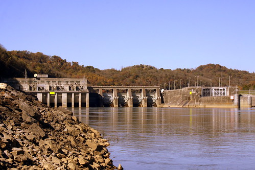
According to Wikipedia:
Cordell Hull Lake is a lake in the Cumberland River in north-central Tennessee, about forty miles east of Nashville, in the vicinity of Carthage. It covers approximately 12,000 acres.
Cordell Hull Dam impounding the Cumberland River was built by the United States Army Corps of Engineers between May 1963 and November 1973 for navigation, hydroelectric power generation, and recreation. The dam is concrete and earthen gravity structure, 87 feet high (above streambed), with a generator capacity of 100 megawatts. It impounds 259,100 acre feet at normal maximum pool, with a maximum flood storage of 310,900 acre feet.
Both are named for Cordell Hull, former United States Secretary of State.
Monday, September 19, 2016
Great Falls Dam and Bridge - Rock Island, TN
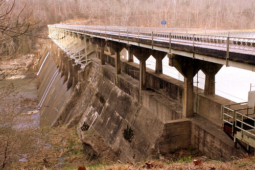
Great Falls Dam is a hydroelectric dam on the Caney Fork, straddling the county line between White County and Warren County. It is the only dam outside the Tennessee River watershed owned and operated by TVA. The dam impounds the Great Falls Lake, and its tailwaters feed into Center Hill Lake. The completion of Great Falls Dam in 1917 was an engineering triumph, marking the first successful attempt to impound the volatile and flood-prone Caney Fork. The dam is also notable for its design, utilizing a mostly underground conduit to carry water from the reservoir via a tributary to the Power House 0.75 miles (1.21 km) downstream from the dam. The dam and its tailwaters are surrounded by Rock Island State Park.
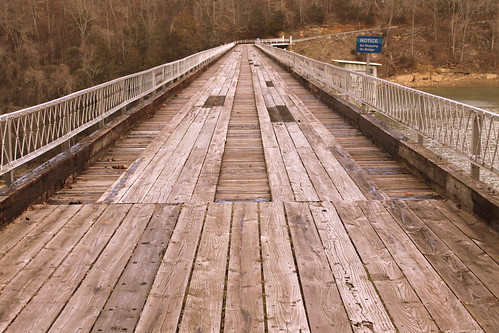
The bridge was first built in 1925. The first time I ever saw it was in 2004. It was still open then but closed soon afterward. It was the first wood surface bridge I ever drove over, and boy was I nervous! At the time, the bridge was also one way, but I'm not sure if it was always like that. Today, the dam and bridge are listed on the National Register of Historic Places.
In 1994, this dam and bridge was a filming location for the movie "The Specialist" starring Sylvester Stallone and James Woods. It is featured prominently in the opening scene of the movie as the their two characters are supposed to blow up the bridge while a Colombian drug lord is driving over it.I guess the movie producers felt it looked like something from a third world nation! Someone has uploaded this segment of the film to youtube in case you're interested, but keep in mind it's from an R-Rated movie.
www.youtube.com/watch?v=tM0i5atnJc4
Saturday, September 3, 2016
Normandy Dam
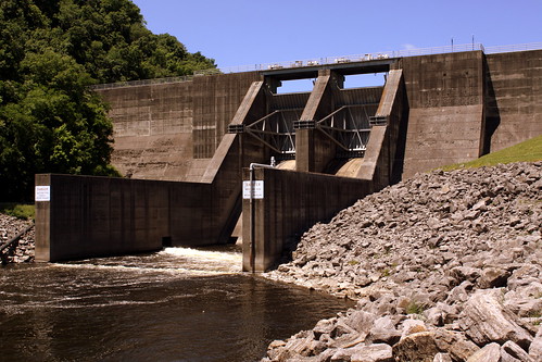
Normandy Dam is a dam built by the TVA on the Duck River It straddles the border between Bedford and Coffee counties. It is the TVA's largest dam that does not produce any electricity. It was built in the 1970s for flood control, water supply and recreational uses.
Thursday, September 1, 2016
Cumberland Mountain State Park Stone Arch Bridge
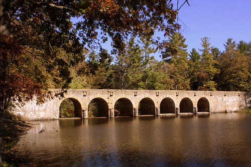
Also known as Byrd Creek Bridge, this concrete stone arch bridge is the centerpiece of the Cumberland Mountain State Park near Crossville, TN. Here, a dam was built on Byrd Creek forming a lake on the southeast side. Highway TN419 carries the seven span bridge which is listed on the National Register of Historic Places as part of the Cumberland Homesteads Historic District. Byrd Creek Dam is the largest masonry structure ever built by the Civilian Conservation Corps. Here is the text of the nearby historic marker:
Men of the Civilian Conservation Corps' Company 3464 built this unsuspended bridge between 1935 and 1940, for a 30-acre impoundment of Byrd's Creek. Three thousand five hundred and fifty cubic yards of dirt and rock were excavated and the core, containing 8,000 tons of concrete, is faced with Crab Orchard stone for the 319-foot span. Seven spillways, rising 28 feet above the stream bed, carry the 18-foot roadway approximately 16 feet above water level.
Thursday, August 18, 2016
Upper DeSoto Falls & Dam
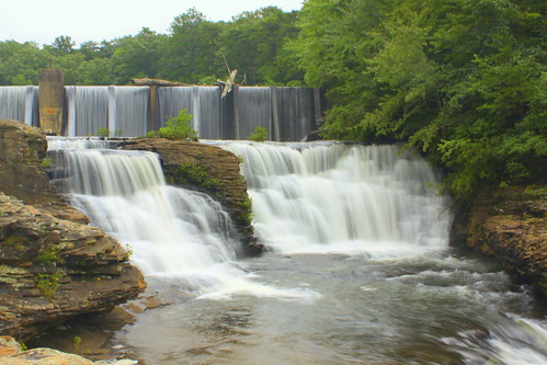
Located atop Lookout Mountain near Mentone, AL is the easily accessible DeSoto Falls.
Downstream from here is the main DeSoto Falls which plunges 104 feet. The upper falls is just a few feet upstream. Beyond that at the top of the photo is a 1920s hydroelectric A.A. Miller Dam.
Friday, July 29, 2016
Replica of Wilson Dam - Florence, AL
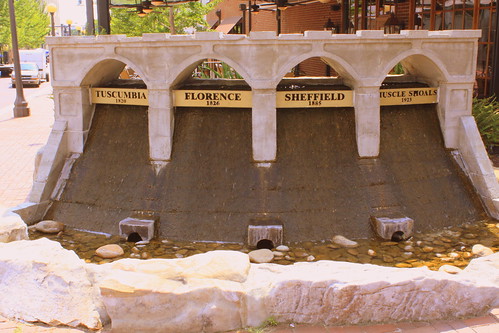
Located in downtown Florence is this fountain-sized miniature of Wilson Dam, in front of Legends Steakhouse. Each of the four cities that comprise "The Shoals" is listed here.
Thursday, March 24, 2016
Railroad Bridge over Barren Fork - McMinnville, TN
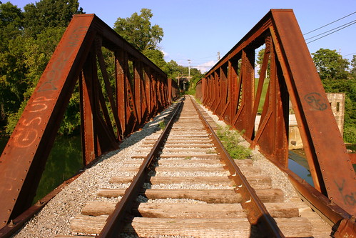
I can't find too much information on how old this bridge is, but there was a railroad line that ran from McMinnville to Tullahoma before the Civil War. During the war, the north destroyed every bridge on this line between the two cities, including the one that crossed the Barren Fork River, which I assume is at this same spot.
Originally, there were multiple mills up and down the river through here, but in 1902, a hydroelectric dam was built, but is not in use anymore. According to a photo on the historical marker nearby, this bridge was already here when the dam was built.
At one time, the bridge was used by NCStL, and then by L&N, and then by CSX. Today, the tracks are used by the short line Caney Fork & Western Railroad, which connects CSX from Tullahoma to Manchester and Sparta.
Saturday, October 24, 2015
Cordell Hull Dam in Autumn (View from Bearwaller Gap Overlook)
According to Wikipedia:
Cordell Hull Lake is a lake in the Cumberland River in north-central Tennessee, about forty miles east of Nashville, in the vicinity of Carthage. It covers approximately 12,000 acres.
Cordell Hull Dam impounding the Cumberland River was built by the United States Army Corps of Engineers between May 1963 and November 1973 for navigation, hydroelectric power generation, and recreation. The dam is concrete and earthen gravity structure, 87 feet high (above streambed), with a generator capacity of 100 megawatts. It impounds 259,100 acre feet at normal maximum pool, with a maximum flood storage of 310,900 acre feet.
Both are named for Cordell Hull, former United States Secretary of State.
Friday, July 17, 2015
A Wide-Angle View of the Entrance to the Ocoee River
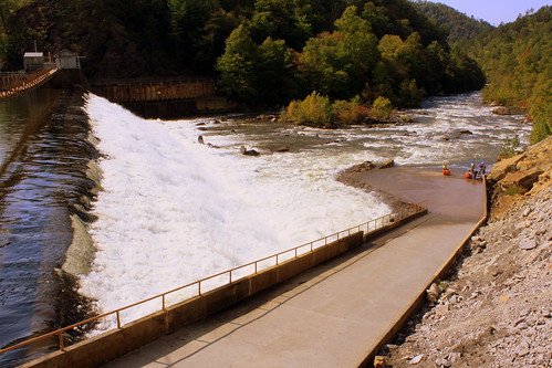
If you are a fan of Whitewater rafting, and you're in Tennessee, the Ocoee River is your place. Now, this photo was taken on a weekday in late September, but in the peak summer months, it can be incredibly crowded. I don't get in the water very often, but the one time I did it, it was here back in 1994.
On the first time you ever visit here, you're greeted with the site of Ocoee Dam #2, and the thought of travelling over it is either thrilling or daunting, depending on your perspective. In reality, it's illegal to go over the 1913 dam and to enter the river, you actually carry your raft/kayak down a concrete ramp. The entrance to the parking lot is from highway US64, which runs just to the right of this photo.
Tuesday, May 19, 2015
Upper DeSoto Falls & Dam
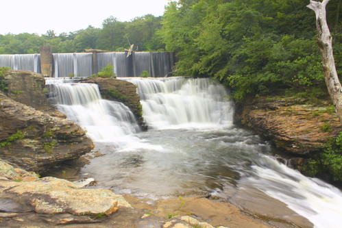
Located atop Lookout Mountain near Mentone, AL is the easily accessible DeSoto Falls.
Downstream from here is the main DeSoto Falls which plunges 104 feet. The upper falls is just a few feet upstream. Beyond that at the top of the photo is the 1920s hydroelectric A.A. Miller Dam.
Subscribe to:
Posts (Atom)