Home     Daily Blog     Galleries     Maps     Contact

Showing posts with label TVA. Show all posts

Friday, November 6, 2020

Douglas Dam - Sevier County, TN

Douglas Dam - Sevier County, TN

en.wikipedia.org/wiki/Douglas_Dam
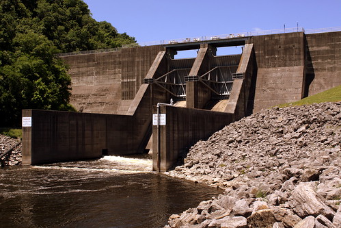
Douglas Dam is a hydroelectric dam on the French Broad River in Sevier County, TN. The dam is operated by the Tennessee Valley Authority (TVA), which built the dam in record time in the early 1940s to meet emergency energy demands at the height of World War II. Douglas Dam is a straight reinforced concrete gravity-type dam 1705 feet long and 202 feet high, impounding the 28,420-acre Douglas Lake. The dam was named for Douglas Bluff, a cliff overlooking the dam site prior to construction.

Friday, May 12, 2017

TVA Cumberland Power Plant

TVA Cumberland Power Plant

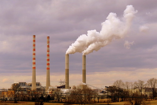
Located in Cumberland City, TN along the banks of the Cumberland River, this power plant produces the most electricity in the TVA system. At 1,001 ft, these two chimneys are two of the 50 tallest chimneys in the world, and among the five tallest when constructed in 1970. The plant is also built at the site of the Wells Creek Crater, a large meteorite impact site from long, long ago.

Friday, March 24, 2017

Cordell Hull Dam

Cordell Hull Dam

According to Wikipedia:
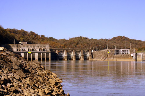
Cordell Hull Lake is a lake in the Cumberland River in north-central Tennessee, about forty miles east of Nashville, in the vicinity of Carthage. It covers approximately 12,000 acres.

Cordell Hull Dam impounding the Cumberland River was built by the United States Army Corps of Engineers between May 1963 and November 1973 for navigation, hydroelectric power generation, and recreation. The dam is concrete and earthen gravity structure, 87 feet high (above streambed), with a generator capacity of 100 megawatts. It impounds 259,100 acre feet at normal maximum pool, with a maximum flood storage of 310,900 acre feet.

Both are named for Cordell Hull, former United States Secretary of State.

Monday, September 19, 2016

Great Falls Dam and Bridge - Rock Island, TN

Great Falls Dam and Bridge - Rock Island, TN

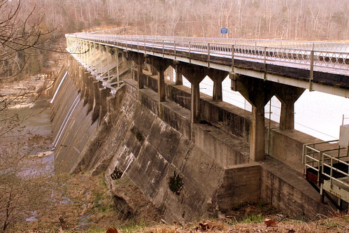
Great Falls Dam is a hydroelectric dam on the Caney Fork, straddling the county line between White County and Warren County. It is the only dam outside the Tennessee River watershed owned and operated by TVA. The dam impounds the Great Falls Lake, and its tailwaters feed into Center Hill Lake. The completion of Great Falls Dam in 1917 was an engineering triumph, marking the first successful attempt to impound the volatile and flood-prone Caney Fork. The dam is also notable for its design, utilizing a mostly underground conduit to carry water from the reservoir via a tributary to the Power House 0.75 miles (1.21 km) downstream from the dam. The dam and its tailwaters are surrounded by Rock Island State Park.

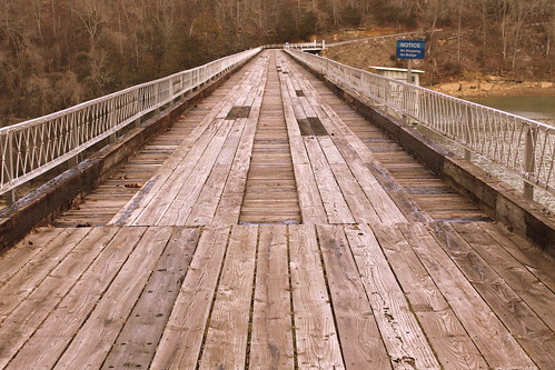
The bridge was first built in 1925. The first time I ever saw it was in 2004. It was still open then but closed soon afterward. It was the first wood surface bridge I ever drove over, and boy was I nervous! At the time, the bridge was also one way, but I'm not sure if it was always like that. Today, the dam and bridge are listed on the National Register of Historic Places.

In 1994, this dam and bridge was a filming location for the movie "The Specialist" starring Sylvester Stallone and James Woods. It is featured prominently in the opening scene of the movie as the their two characters are supposed to blow up the bridge while a Colombian drug lord is driving over it.I guess the movie producers felt it looked like something from a third world nation! Someone has uploaded this segment of the film to youtube in case you're interested, but keep in mind it's from an R-Rated movie.
www.youtube.com/watch?v=tM0i5atnJc4

Great Falls Dam Bridge - Rock Island, TN

Saturday, September 3, 2016

Normandy Dam

Normandy Dam

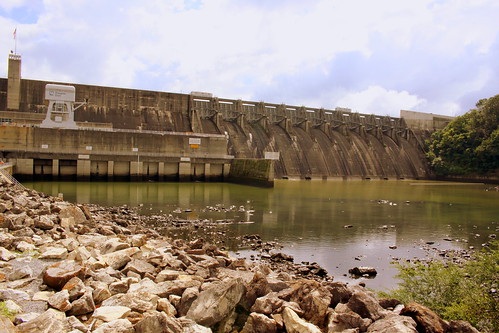
Normandy Dam is a dam built by the TVA on the Duck River It straddles the border between Bedford and Coffee counties. It is the TVA's largest dam that does not produce any electricity. It was built in the 1970s for flood control, water supply and recreational uses.

Saturday, October 24, 2015

Cordell Hull Dam in Autumn (View from Bearwaller Gap Overlook)

Cordell Hull Dam (View from Bearwaller Gap Overlook)

According to Wikipedia:
Cordell Hull Lake is a lake in the Cumberland River in north-central Tennessee, about forty miles east of Nashville, in the vicinity of Carthage. It covers approximately 12,000 acres.

Cordell Hull Dam impounding the Cumberland River was built by the United States Army Corps of Engineers between May 1963 and November 1973 for navigation, hydroelectric power generation, and recreation. The dam is concrete and earthen gravity structure, 87 feet high (above streambed), with a generator capacity of 100 megawatts. It impounds 259,100 acre feet at normal maximum pool, with a maximum flood storage of 310,900 acre feet.

Both are named for Cordell Hull, former United States Secretary of State.

Thursday, September 19, 2013

Kingston Steam Plant

Kingston Steam Plant

My wife and I have a tradition, any time we make the drive between Knoxville and Nashville, whoever is in the passenger seat gets out the camera and takes a picture of the Kingston Steam Plant (aka the Kingston Fossil Plant) while crossing the Interstate 40 bridge over Watts Bar Lake. Somehow, both of us missed the story when the plant made national news with the coal fly ash slurry spill which was one of the worst environmental disasters in state history.

Friday, June 14, 2013

Ocoee Dam No. 1

Ocoee Dam No. 1

Ocoee Dam No.1 is located a few miles downstream from the famous Ocoee River whitewater rafting area, and this overlook is provided next to a small turnoff along US64/74. It is listed on the National Register of Historic Places.
According to the marker:

Park's Mill occupied the site of Ocoee No.1 from the mid 19th century until 1910 when the Tennessee Electric Power Company acquired the site for construction of a hydro plant.

Ocoee No. 1, Tennessee's first large hydroelectric plant, was the result of efforts by a small group of visionaries who saw the benefits of electric power to the manufacturing industries of the south.

Built in just 18 months, in 1912 Ocoee No. 1 began providing electricity for Chattanooga and the surrounding area. In 1939, TVA acquired both Ocoee No.1 and No.2 and electricity generated at the Ocoee plants became part of TVA's growing network of power plants in the Tennessee Valley.

Wednesday, April 3, 2013

Tri-State Spot in the News: Tennessee, Georgia and Alabama

Tri-State Spot in the News: Tennessee, Georgia and Alabama

In the United States, there are 62 spots where 3 or more states meet at a single point, 38 of which are on land. Of these 38, perhaps none of them have made as much news over the last several years as the spot where Tennessee, Georgia and Alabama all meet.

In 1796, the U.S. congress established the border between Tennessee and Georgia to run along the longitude of the 35th Parallel. In 1926, Georgia hired Mathematician and University professor James Camak to mark the spot where the three states came together. After he performed all of his calculations, he placed a colorful stone at the site he had measured (and the stone was later dubbed the Camak Stone). As it turns out, he missed it by a mile. While it wasn't what the Congress decreed, it still became the official border location. If there was a TV show called "Surveyors Biggest Bloopers" perhaps this would make the opening segment.

Fast forward about 180 years and people weren't laughing any more. The state of Georgia was going through a drought and Atlanta area gardens started to get thirsty. That's when somebody remembered part of their state had been sliced off. As it turns out, if the Camak Stone had been placed where it ought to have been, a smidgen of the Tennessee River, and more importantly the Nickajack Lake impoundment would be in Georgia. Someone daydreamed of getting a siphon as wide as the Keystone Pipeline and all of Georgia's water consumption needs would be fixed. All they would need is to stick a pipe about 500 feet across the border and the crisis would be resolved. Georgia asked politely and Tennessee said "No." From there, it is presumed that someone got angry and wanted revenge because the really old Camak Stone was stolen in 2007. We can only assume at the motivation because there's no evidence whodunit. In March of 2011, the marker seen in this photo was placed to replace the stolen stone from a few years earlier.

Fast forward again to March 25, 2013 where the Georgia state senate voted 48-2 to take what they think is rightfully theirs. Instead of asking for everything south of the 35th, they're looking to add about one and a half square miles of land, or a small notch to get to the precious life-giving water. Again, Tennessee said "Nickajack is ours, and you can't have it!" They also noted it would be unfair for the people who live in this area to have to start paying GA income tax while also speculating the Peach State might steal the whole river when nobody's looking. Alabama refuses to take a position in the matter, but they already have all the Tennessee River they need.

As it turns out, I hadn't been paying attention to the news when three days later I was in the mood to visit the tri-state spot. I didn't see any tanks or infantry ready to defend their territory in the area. To get here, the street turns a corner around State Line Cemetery and there's a place for a car to park on the side of the road. From here, there's a small opening in the trees that begins the path through the woods. The walk is about 300 feet up the side of a mountain where I was thankful it wasn't a mile climb up the mountain. From here, you could even see the lake. I was thinking that if Georgia's border did change, Alabama's wouldn't and this would still be the three state spot, but the marker would still have to be changed. Maybe someday I can have a before-and-after comparison. Still, State Line Cemetery's name would have to be changed.

Tri-State Spot in the News: Tennessee, Georgia and Alabama

Tuesday, June 5, 2012

Post Card Tuesday: Hales Bar Dam and Bridge


This is a real photo postcard that has been dated 1936 at the bottom. The labels at the bottom read: Hales Bar Power Plant, Tennessee Valley, Dixie Highway - U.S. 41.

Lets start in the foreground, with the Dixie Highway Bridge. This bridge was in the news a couple of months ago as TDOT announced plans to repair the bridge over the Tennessee River, and it has been closed for a while. It runs parallel to Interstate 24, so these days not as many people need to use it. One other thing to note, with the creation of Nickajack Lake, which will be discussed on down a bit, the water level of the river is higher and at the time, they had to hydraulically lift the bridge 24 feet so there would still be room for boats to pass underneath. Here is a recent photo of the bridge under construction:

Marion Memorial Bridge

Now, on to what today remains of Hales Bar Dam.

Hales Bar Dam (remains)

Hales Bar Dam was a hydroelectric dam located on the Tennessee River in Marion County near Halestown (aka Guild). The Chattanooga and Tennessee River Power Company (TEPCO) began building the dam in 1905 and completed it in 1913, making this dam one of the first multipurpose dams and one of the first major dams to be built across a navigable channel in the U.S. In 1939, TVA assumed control of the dam after purchasing TEPCO's assets. TVA then spent two decades trying to fix a leakage problem that had plagued the dam since it's construction. After continued leakage, it was determined that expanding the dam's navigation lock would be too expensive. TVA decided to replace this dam by constructing Nickajack Dam 6 miles downstream in 1968. Today, what's left just looks like it protrudes out into the river while serving no purpose.

Hales Bar Dam (remains)


Friday, April 15, 2011

Your Tax Dollars at Work

Big Waste of Money

I'm not in a mood to get political, but hey there's something you can't ignore when April 15th comes around. Luckily, if you stumble across this and you haven't done them yet, you've got a couple of bonus days this year!

In the 1960's while planning for the upcoming need for more electricity, TVA bought some land off the Cumberland River in Trousdale County. Plans called for a Cooling Tower for the Hartsville Nuclear Power Plant. Construction started on the plant in 1975. It got this far to make what you see here, but in 1984, the plans were cancelled. I don't want to think about how much money was spent on it.

Saturday, December 18, 2010

Driving around Raccoon Mountain

Driving around Raccoon Mountain

This...Whatever this is...can be seen while driving through the Raccoon Mountain TVA area. The Tennessee River is in the background. Driving up this road will eventually take us to the observation point which gives a good view of Lookout Mountain and Chattanooga Below. This street also takes us to the Raccoon Mountain reservoir which is part of the TVA power system. However its just odd to see this machinery on the side of the road in an otherwise scenic setting.