Home     Daily Blog     Galleries     Maps     Contact

Monday, August 31, 2020

Annie Oakley Statue made of Scrap Metal

Annie Oakley Statue made of Scrap Metal

This life-size statue of Annie Oakley was created by Ryan Barbour of Barrel House Metal Works in Clarksville, TN. It is on display outside Lewis Country Store. This store is located in the Scottsboro area of Nashville, where Old Hickory Blvd. intersects with Ashland City Hwy (TN12).

Sunday, August 30, 2020

Berlin Spring - Marshall County, TN

Berlin Spring - Marshall County, TN

Berlin Spring, or Big Spring is a cave spring that begins Cedar Creek in northwest Marshall County. Over 170 years ago, the small town of Berlin formed around the source of water. The small park which is located just off US431 is also home of the once famous Berlin Rock (or Pulpit Rock). The Berlin Rock at it's scenic location made for a popular spot for all local politicians to give campaign speeches.

For more info, see the text of this 40 year old newspaper article:
freepages.school-alumni.rootsweb.ancestry.com/~bethlehemc...

Berlin Spring (alt) - Marshall County, TN

Saturday, August 29, 2020

Harlinsdale Farm's Main Horse Stable - Franklin, TN

Harlinsdale Farm's Main Horse Stable - Franklin, TN

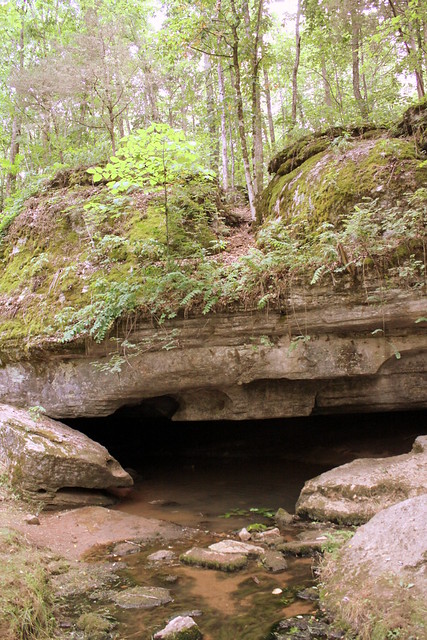
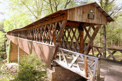
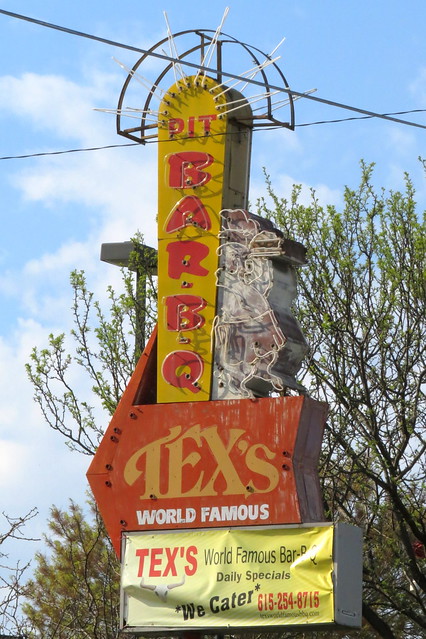
Harlinsdale Farm is a historic farm for breeding Tennessee Walking Horses. The farm was purchased by the city of Franklin to preserve history and to be used as a park.

Here is a portion of the National Register of Historic Places writeup of this stable. Read the PDF for the thorough story.
npgallery.nps.gov/pdfhost/docs/NRHP/Text/06000344.pdf

Harlinsdale Farm is a 198-acre historic district north of downtown Franklin on the west side of U. S. Highway 31 (Franklin Road). The highway provides a portion of the western boundary of the property while the Harpeth River is the eastern boundary. The property's entrance faces the location of the historic Dortch Stove Works (Now The Factory at Franklin). The nominated property contains 18 contributing and 4 non-contributing resources. The related buildings and structures of the Harlinsdale stables visually dominate the nominated property. The stables are connected to the highway by a paved driveway, which is lined by a white board fence that splits the eastern most horse pasture into two separate fields. Large expanses of open land, critical for a training stable, characterize the farm.

Main Horse Stable (1935)

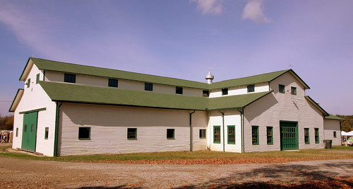
At the center of the complex, approached by a paved road, is the main horse stable, completed in 1935. Set back about 680 feet from Franklin Road, the long facade of the gable end stable is parallel to the road and only the wood fence lining the drive to the barn interrupts the view. This arrangement was an innovation in the modem revival of the Tennessee Walking Horse industry in the 1930s.

The one story plus monitor roof main horse stable is capped by a green asphalt shingle gable roof, sheathed with white weatherboard and green wood trim, and rests on a concrete slab foundation. It has a centered gable bay entrance on both front and rear facades and two side wings, creating a cross-shaped plan precedent setting for Tennessee Walking Horse stables. This bay projects approximately fifteen feet from the wings, which are approximately forty feet long. The front, or east facade (street facade) has two wood six-over-six double hung sash windows flanking the one-story overhead rolling "garage-type" door on the central projecting bay. Above the door in the monitor roof are two three-paned single sash windows with a single metal tube centered between them that projects, curving downward. The walls are constructed of five-inch weatherboarding. The first story wings each contain four open, barred, and symmetrically placed square windows. The monitor roof repeats this pattern but with five windows, two of which abut the central bay.

The principal features of the south elevation are the two sliding wood doors. Each door has a square six-pane window. Flanking the entry doors are square windows identical to those on the east facade, while the monitor roof also repeats the window and lighting pattern of the east facade. Also visible are the south elevations of the central bays of the east (farm side) and west (street side) facades. Evident on the eastern part are two six-over-six double hung sash windows on the first story and two triple paned single sash windows in the monitor roof. The western section has one six-over-six double hung sash window on the first story.

Harlinsdale Farm is eligible for listing in the National Register of Historic Places for its statewide significance in agriculture as Tennessee's most significant extant historic stables associated with the modern Tennessee Walking Horse industry from 1935 to 1956. The property also possesses local architectural significance as a cohesive, extant collection of buildings that became a model for the image and appearance of the Tennessee Walking Horse stables. Dating from c. 1900, the farm complex represents an archetypical Middle Tennessee farm that would turn into one of the premier Walking Horse sites in the state. The collection of buildings includes the walking horse farm and the dairy farm complexes, complete with laborer houses, equipment sheds, a smokehouse, a farmhouse, various horse and livestock barns, a dairy barn, and silos.

Due to its success as a Walking Horse breeding and training center, Harlinsdale Farm has been a model by which other breeders and trainers in the industry have patterned the layouts of their stables. Other successful horse breeding farms, such as Haynes Haven in Spring Hill, Maury County, and the Wilson Farm in Sumner County, followed the precedents of Harlinsdale's design and layout. Instead of the traditional Tennessee placement of the main barn behind a centrally located house, with the barn's primary entry being on its gable end and facing the rear of the house, the Harlins chose a new model that highlighted the horse stables. By drawing attention to the central structure, through a lengthwise positioning and unusual cross-gable placement of the primary entryway and facade on this long side, the architecture becomes a social statement of pride and position. The main horse barn contains impressive craftsmanship and balances work spaces for employees and stalls for the horses. Its exterior facade reflects an unmistakable 1920s industrial aesthetic: here was a facility to produce horses, large numbers of them, for sale.

Friday, August 28, 2020

The Peabody Hotel neon sign

The Peabody Hotel neon sign

The Peabody Hotel is the most famous grand hotel of Downtown Memphis. This neon sign is atop the building. This view is from around Beale St.

Thursday, August 27, 2020

Faded Coca-Cola (and Ford) wall ad - Fayetteville, TN

Faded Coca-Cola (and Ford) wall ad - Fayetteville, TN

These faded wall ads are a block south of the Fayetteville town square. The easiest to read wall ad says "Drink Coca-Cola - Every Bottle Sterilized" but the words Refreshing & Livelier also show through, as well as a Ford logo.

Tuesday, August 25, 2020

Pagoda of Medicine - Nashville, TN

Pagoda of Medicine - Nashville, TN

In 2015, Historic Nashville Inc. listed Pagoda of Medicine on their Nashville Nine, a yearly list of endangered historic properties. Here is their write-up:

historicnashvilleinc.org/nashville-9/pagoda-of-medicine/

Constructed in 1963, the Pagoda of Medicine is a Mid-Century Modern building associated with Nashville’s African-American history. Located on the former Riverside Adventist Hospital campus, the building was originally owned by Dr. Carl Ashley Dent (1914-1995), an African-American physician and missionary for the African-American Seventh-Day Adventist Church, founded in Nashville in 1883. A native of Georgia, in 1938 Dr. Dent became the first African-American offered a medical internship at Los Angeles County General Hospital. In 1940, Dr. Dent was hired as medical director of Nashville’s Riverside Sanitarium, founded in 1927 as a segregated hospital for Nashville’s African-American residents. Riverside focused on alternative therapies and became a mecca for African-American physicians, nurses, and patients from around the country.

In 1963, Dr. Dent constructed the Pagoda of Medicine for his private medical practice. The building’s design is attributed to Leon Quincy Jackson (1926-1995), a notable African-American architect. A native of Wewoka, Oklahoma, Jackson earned an architecture degree from Kansas State University and a master’s in urban planning from the University of Oklahoma, where he studied under renowned architect Bruce Goff, a protégé of Frank Lloyd Wright. In 1950, Jackson became the first African-American architect to open an office in Oklahoma. Jackson moved to Nashville in 1954 to teach engineering at TSU where he established the architectural engineering program. He also operated a private architectural practice and designed private homes, health clinics, churches, civic buildings, educational facilities, and residential towers. Several of Jackson’s Mid-Century Modern landmarks in Nashville still stand.

In 1984, after the retirement of Dr. Dent the Pagoda of Medicine was rehabbed for use by Dr. G.B. Alford. The Riverside Adventist Hospital campus closed in 1999 was renovated in 2002 for use as an assisted living facility. Vacant since 2008, the Pagoda of Medicine retains its original architectural integrity, but has suffered from water damage and vandalism. The building is currently owned by the Seventh-Day Adventist Church.

Monday, August 24, 2020

L&N Caboose #156

L&N Caboose #156

L&N Caboose #156 appears to be on private property but easy to view in Ardmore, AL. The spot labelled as Steve's Junction is along 7th St. fairly close to the live tracks.

Sunday, August 23, 2020

Davidson County Courthouse (old) - 2016 Wide-angle view

Davidson County Courthouse (old) - 2016 Wide-angle view

The 1937 Davidson County Courthouse was the 5th (of 6) to be used in Nashville.

In 1935, the Courthouse of 1857 burned, and the county decided to make the replacement building in the public square the County Courthouse and Nashville City Hall.

A Competition was held to design the new building, and the winning Architects were Emmons H. Woolwine of Nashville and Fredrich C. Hirons of New York with their PWA-influenced Art Deco design. The Cornerstone was placed on Aug. 10, 1936 and was dedicated on Dec. 8, 1937. The building cost $2,000,000 and was the first building in the city with air conditioning. The building is eight stories high and measures 260 feet by 96 feet. The official title of the building was Davidson County Public Building and Court House.

After several decades of use, updates were needed. Starting in 2003, the Courthouse began an extensive renovation. (When I was summoned for jury duty, courts were held in MetroCenter.) For additional space, a newer courthouse was built nearby with similar design themes. Also, the surface parking lot in front of the courthouse was replaced by an underground lot, and a small public park. The park has an observation deck, large lawn, small reflecting pool and picnic tables.

The quality of the Architecture placed the building on the National Register of Historic Places. As a significant Public Works Administration project, it is an example of Government Art Deco. The symbolism and Classical Columns are typical of a public building. The excellent craftsmanship is seen in the decorative work: Bronze castings, terra cotta and carvings.

Saturday, August 22, 2020

Neil House - From Trenton to Jackson, TN

Neil House - From Trenton to Jackson, TN

The Neil House was originally built in 1837 in Trenton, TN. The antebellum plantation house was built in a Federal style with two large porches, 14-foot ceilings and 12-foot windows. The home played a role in the Civil War Battle of Trenton as citizens gathered on the roof to watch the battle unfold. Later, it became the home to Tennessee Supreme Court Chief Justice M.M. Neil. It was the centerpiece of the Trenton Historic District on the National Register of Historic Places.

The Trenton Historic District has multiple churches all bunched together and one of those congregations felt they needed more parking spaces. At the time, the home was not lived in, although it was in decent condition for the age. The church owned the property and decided to turn it into a parking lot. Preservationists were not happy.

Thankfully in this case there is a happy ending. The home was purchased by the Shaw family which owns Brooks Shaw's Old Country Store at Casey Jones Village in Jackson, TN. In 2010, the home was split in half and transported to Casey Jones Village. This photo was taken while the renovations were almost complete. Today, the home is restored and fitted with retro furniture under the name Providence House, and is available for events.

Friday, August 21, 2020

The man who named the U.S. Flag "Old Glory"

The man who named the U.S. Flag "Old Glory"

This is the burial site of William Driver who gave the U.S. Flag the nickname of "Old Glory." He is buried in Nashville City Cemetery. Read more about driver here: tennesseeencyclopedia.net/entries/william-driver/

As a child, I visited this site on a 7th grade field trip. At the time, I didn't particularly care about history, but this is the only thing I remember from the trip. When I revisited the cemetery in 2019, I made sure to revisit this grave.

Around 2006, his flag was on display as a special exhibit at the Tennessee State Museum.

Thursday, August 20, 2020

Clarkson Covered Bridge - Near Cullman, AL

Clarkson Covered Bridge

From Wikipedia:
en.wikipedia.org/wiki/Clarkson%E2%80%93Legg_Covered_Bridge

The Clarkson–Legg Covered Bridge, more simply known as Clarkson Covered Bridge, is a county-owned wooden covered bridge that spans Crooked Creek in Cullman County, Alabama, United States. It is located at Clarkson Covered Bridge Park on County Road 1043 (CR 1043) off U.S. Route 278 near the community of Bethel, about 8 miles (13 km) west of Cullman.

Originally built in 1904, the 270-foot (82-meter) bridge (although some other sources say the bridge is only 250 feet long, including NRHP) is a Town Lattice truss construction over four spans. The Clarkson–Legg Covered Bridge was listed on the National Register of Historic Places on June 25, 1974. It is currently the second-longest existing covered bridge in Alabama and one of the longest in the United States. The bridge is maintained by the Cullman County Commission.

The Clarkson–Legg Covered Bridge was constructed over Crooked Creek in 1904 on property owned by local mail carrier James W. Legg at the cost of $1,500. It was originally named the Legg Covered Bridge after the landowner, who saw the need for transportation improvement in the area and even supplied much of the materials. A flood destroyed half of the bridge in 1921. Most of the pieces were recovered downstream, and the bridge was able to be rebuilt the following year, with help from a contractor hired by Cullman County, also at a cost of $1,500. The covered bridge remained in service to motor traffic until 1962, when it was bypassed by a nearby concrete bridge. As part of the American Bicentennial Project, the Clarkson–Legg Covered Bridge was restored by the Cullman County Commission in 1975, along with a gristmill and log cabin also located at Clarkson Covered Bridge Park. A number of activities are now held at the park, including an annual event by the county called Old-Fashioned Days.

On Christmas Day of 2015, many of the paths and walkways within Clarkson Covered Bridge Park were damaged due to flooding after 8 inches (20 cm) of rain fell in a 24-hour period. The covered bridge itself was unharmed. Although the flood was not as significant as the one which occurred in 1921, it did require the park to be closed to the public while repairs were made. The park reopened on January 13, 2016.

Clarkson Covered Bridge northwest end

Clarkson Covered Bridge inside

Clarkson Covered Bridge (alt view)

Wednesday, August 19, 2020

Capt. Jeff Kuss USMC Memorial - Smyrna, TN

Capt. Jeff Kuss USMC Memorial (2) - Smyrna, TN

Description of the memorial:
www.captjeffkussusmcmemorial.com/
On June 2, 2016, at the age of 32, Kuss tragically lost his life when his jet crashed a day before the Great Tennessee Air Show in Smyrna. A Blue Angel F/A-18C Hornet similar to the jet flown by Captain Kuss and on loan from the National Aviation Museum in Pensacola, FL.

Although I wasn't home at the time, I live less than a mile from where Capt. Kuss crashed in Smyrna. This memorial is also nearby, located on TN266 Sam Ridley Pkwy and across from the Smyrna MQY airport. Parking is available at Lee Victory Park.

Tuesday, August 18, 2020

Indian Mound #1, Fewkes Site - Brentwood, TN

Indian Mound #1, Fewkes Site - Brentwood, TN

The Indian Mound seen here has been undisturbed since it's creation between 900-1450 A.D. It is one of five mounds located next to Boiling Springs Academy at Primm Springs Park in Brentwood, and the only one not partially excavated.

For much of the early 20th century, the surrounding land was used as a pasture on the Primm family farm.

Starting in 1920, the Smithsonian sent archaeologist William Myer to the site to conduct a formal scientific excavation and testing of the other four mounds. His research detailed artifiacts and graves found, evidence of prehistoric dwellings, and discovery of different phases of mound construction. On the other side of this mound, a slave burial ground was found, most bodies from before the Civil War.

Overall, the site retains most of its historical and archaeological integrity and has been named the Fewkes Group Archaeological site. In 1980, the site was added to the National Register of Historic Places. In 2003, the Primm family donated the land to the city of Brentwood to be a park and to help preserve the history here.

Monday, August 17, 2020

Abandoned School Bus

School's Out

This abandoned bus was seen in the Oak Grove area of Sharp's Chapel, TN.

Sunday, August 16, 2020

Savannah, TN Historic District: E.W. Ross House

Savannah, TN Historic District: E.W. Ross House

Built in 1908 and located along Main St. (US64) The Savannah Historic District is a group of 17 homes that form together to become an entry on the National Register of Historic Places.

Saturday, August 15, 2020

Tex's Bar-B-Q neon sign - Nashville, TN

Tex's Bar-B-Q neon sign - Nashville, TN 

Tex's World Famous Barbecue - Located along Foster Ave. near Murfreesboro Rd.

Sunday, August 2, 2020

Holston Road (aka Avery Trace) - Bledsoe's Fort Historical Park

Holston Road (aka Avery Trace) - Bledsoe's Fort Historical Park

"You are now on a section of the first wagon road to the Cumberland Settlements from East Tennessee. Blazed in 1787."

Located at Bledsoe's Fort Historical Park near Castalian Springs in Sumner County, TN. I walked down this road, but it wasn't clear when the old road stopped and it became a nature trail that loops around to the other side of the park.

One thing that is not explained is this sign used to call this the "Avery Trace" instead of "Holston Road." Here is what Wikipedia has to say about the Avery Trace at this spot:

The first major road connecting the Upper Cumberland region with settlements to the east, known as Avery's Trace, was completed in 1788. The road, which connected Fort Southwest Point with Nashville, passed a few hundred feet east of Bledsoe's Station. Guests at Bledsoe's Station in the 1790s included French botanist André Michaux and Louis-Philippe, Duke of Orléans and later king of France. General James Winchester, who helped establish Cairo to the southwest and was later instrumental in the founding of Memphis, purchased Bledsoe's Station in 1797. The following year, Winchester completed Cragfont near Bledsoe Creek about a mile to the west. In 1807, a pioneer from North Carolina named Jeremiah Belote (d. 1822) purchased Bledsoe's Lick, and his descendants would retain possession of the property for several decades
en.wikipedia.org/wiki/Bledsoe%27s_Station#Later_history

This website helps explain the correction from Avery Trace to Holston Road:

The area which we are intensely involved with is the trail/road/trace from Western Jackson County, thru Fort Blount, Bledsoes Lick, Manskers Station and Nashville. We have reviewed 40 microfilm rolls of Record Group 1177 from North Carolina containing over 16,000 grants. These records contain warrants and surveyor documents with plats for land which was set out originally as a means of payment to North Carolina soldiers. The word "Avery" in any form is not mentioned in any of these grants. A few examples of what the surveyors called the road was: Waggon Road leading to Nashville, road leading from Bledsoes Lick to Holston, Holston Road, Holstein road, Road to Holson, road leading from Bledsoes Lick to Holston, Waggon Road leading to Nashville, Settlement Trace and road from Bledsoes licke to Holston. Individual sections in our focus area were called such names as Gibson Trace and Lower Goose Creek Trace for example. For the purposes of our study we are calling the road/trace/trail "Holston Road" since most of the descriptions include the word Holston.
www.cumberlandpioneers.com/averytrace.html

Saturday, August 1, 2020

Cogbill's General Store - LaGrange, TN

Cogbill's General Store - LaGrange, TN

This General Store in LaGrange, TN dates back to the 1860s when William Peter Lipscomb opened a business. That business was lost due to a 1900 tornado. Lipscomb opened a new store at this location and was passed down through the family as Charles Lipscomb Cogbill operated the store in the 1960s. In 1991, Lucy Cogbill reopened the store with Sherri Bruner-Osteen. A fire in 1998 destroyed the 1901 building and this store was soon rebuilt.