The Daily blog of SeeMidTN.com, pictures from Middle Tennessee and nearby cities.
Showing posts with label Tennessee River. Show all posts
Sunday, April 24, 2022
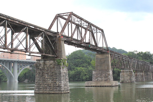
Norfolk Southern Tennessee River Bridge - Knoxville
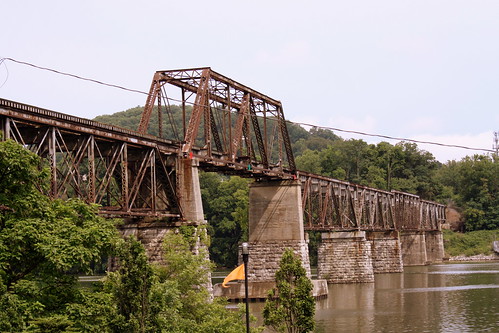
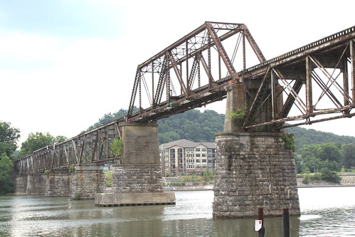
Located in downtown Knoxville, this railroad bridge now used by Norfolk Southern has elements dating back to the Civil War, but has been rebuilt several times.
The stone piers and approaches are the oldest element of the bridge, dating back to the 1850s. Wooden spans were completed in 1867. In 1903, wooden spans were replaced with a steel trestle. It underwent a major rebuild in 1940. A tugboat hit one of the piers in 1993 and that pier was fortified. The center span of the bridge is a Pratt through truss and the other segments are Warren deck trusses.
The original builder of the bridge was Knoxville & Charleston Railroad which chartered in 1852. In the 1870s, they became the Knoxville & Augusta Railway. In 1890, they were bought out by East Tennessee, Virginia and Georgia Railway. Then, in 1894 they were bought out by Southern Railway.
Labels:
Bridge,
Knoxville,
Norfolk Southern,
Tennessee River
Sunday, January 23, 2022
Market Street Bridge - Chattanooga
Monday, November 30, 2020
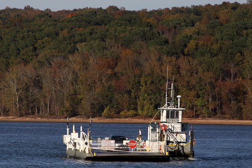
A trip on the Benton-Houston Ferry across the Tennessee River
This Tennessee Ferry connects Benton County and Houston County across the Tennessee River. Also, the ferry connects both sides of highway TN147 to the cities of Big Sandy and Erin. The ferry runs every day of the year unless there is bad weather, and the ride costs $1.
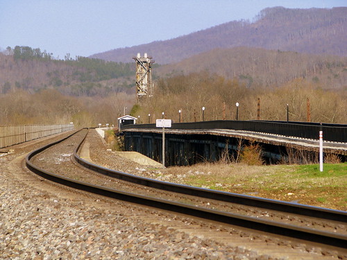
One of the things to see during the ride is a partially abandoned railroad bridge and a partially submerged grain elevator.
There are only two working Ferries in Tennessee. The other one crosses the Cumberland River in Stewart County, seen here:
flic.kr/p/DpgmfS
Labels:
Benton County,
ferry,
Houston County,
Tennessee River
Saturday, June 6, 2020
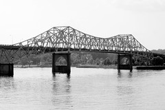
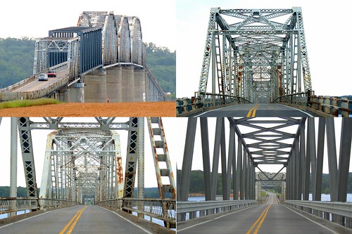
O'Neal Bridge - The Shoals, AL
The O'Neal Bridge was built in 1939 to connect automobile traffic between Florence, Al on the north side to Sheffield and Muscle Shoals on the south side. The 2,071 ft. Cantilevered Warren through truss designed bridge crosses the Tennessee River. Highways US43 and US72 use the bridge that connects Lauderdale and Colbert Counties. The bridge was named in honor of Alabama's Father & Son governors Edward A. O'Neal and Emmett O'Neal.
When originally designing the bridge, engineers knew the southern side is on a bluff, and the northern side would need to be raised for the deck to be level. Dirt was excavated from the area to the west of bridge site on the north shore to form a hill, and the resulting empty space became Florence Harbor.
Also, when the bridge was originally completed, there was a pedestrian lane in the middle. The sidewalk leading to the bridge proceeded down a ramp under the bridge, which then ramped back up to an area between the lanes to the walkway. This walking lane was removed in the 80's during a lane widening project, but the access ramp is still there in the south end, although locked.
Saturday, August 12, 2017
Old and New Bridgeport, AL river bridge
This is an important spot for railroads in the south as all of the CSX trains that run from Nashville to Chattanooga cross through here. I can't find any details on how old the old bridge is, but the river was first crossed here by NCStL in 1852.
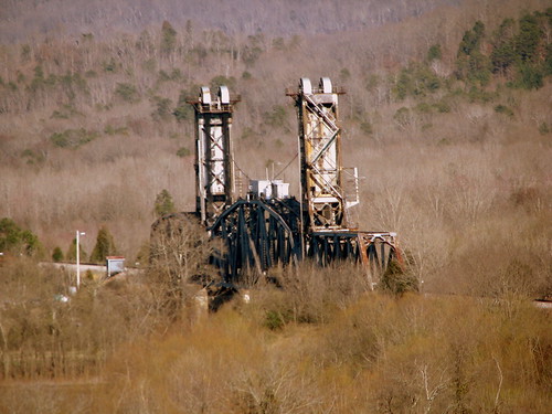
The bridges here cross the Tennessee River. One of the reasons this spot was picked is there is an approx 1000 ft. island 2/3 of the way to the other side at this spot. The tracks cross the wider 1000 ft. portion of the river with what you see in the foreground, and then there is a smaller 500 ft. lift bridge in the background.
The lift bridge was placed here in 1981 from unused train line elsewhere. It's rather inaccessible unless you're a railroad employee who takes a gravel road on the other side.
Unfortunately, the pedestrian bridge clearly marks it's for employees only, which is a shame.
I'm not sure how new the new bridge on the left is. It's at least newer than 1995. On GreenFrog.com, (a great website for railfan videos) they have a CSX video from Chattanooga to Nashville, filmed in the mid 90's and featuring the bridges here before the new one was built.
Labels:
Alabama,
Bridge,
Bridgeport,
CSX,
NCStL,
Tennessee River
Saturday, December 31, 2016
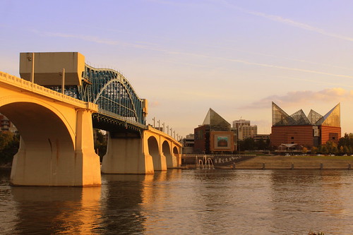
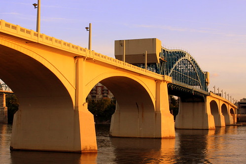
Market Street Bridge & Aquarium
Chattanooga Landmarks: Market Street Bridge & Chattanooga Aquarium
Seen from across the Tennessee River soon before sundown.
Labels:
Aquarium,
Bridge,
Chattanooga,
Downtown,
Tennessee River
Friday, September 2, 2016
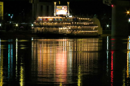
Southern Belle Riverboat at Night - Chattanooga
Located in downtown Chattanooga, the photo was taken from an observation pier from across the Tennessee River.
Labels:
Chattanooga,
night,
riverboat,
Tennessee River
Wednesday, August 31, 2016
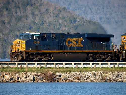
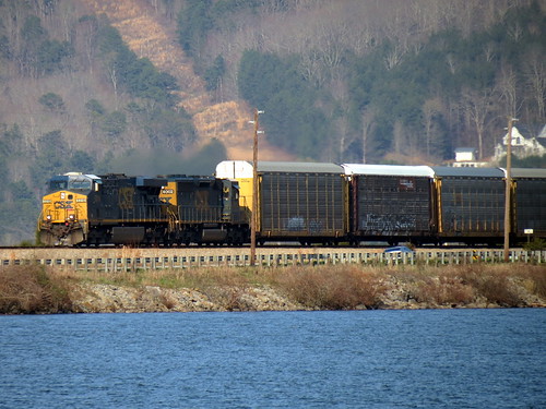
CSX 5318 Crosses the Nickajack Lake Causeway
Nickajack Lake is formed by Nickajack Dam on the Tennessee River in Marion County, TN. This causeway carries one set of tracks as well as highway TN156. The tracks are part of the CSX mainline and every train from Chattanooga to either Nashville or Huntsville passes through here.
Labels:
CSX,
Marion County,
Nickajack Lake,
Tennessee River,
train
Friday, August 5, 2016
The Old Railroad Bridge - Pedestrain walkway - Florence, AL
The Old Railroad Bridge dates back over 140 years as an important crossing of the Tennessee River between Florence and Sheffield in The Shoals area of Alabama.
Back in 1840, the first bridge at this location opened. It significantly damaged by tornadoes and storms all through the 1850's and eventually that bridge was destroyed during the Civil War.
In 1870, the Memphis & Charleston Railroad decide to build another bridge at this spot. Over the next 120 years, there is quite a lengthy history about who got to use the bridge and changes to the bridges configuration. I'll hit some of the highlights, but below I'll link to a thorough history.
Originally, there was not a method for tall ships to go through, so a drawbridge was installed in 1872 along the northern end. A new drawbridge was installed in 1906. In 1948, the drawbridge was replaced with a turn span was installed. (When the bridge was open to tall ship, this span pivoted or rotated counter-clockwise and had stone piers to rest upon.) In 1962, this segment was changed again to a lift bridge, raising to 350 feet of clearance over the water. In 1988, all railroads abandoned the bridge and the lift section was completely removed.
This bridge not only carried railroads on the top, but also had a lower deck for vehicular traffic. This closed in 1939 with the opening of the O'Neal Bridge.
Other railroads that used this bridge were Virginia & Georgia; Nashville, Florence & Sheffield; L&N; Southern; Around 1903, a streetcar service also used the rails to get passengers from one side to the other and it lasted until 1933.
The complete history is here:
www.oldrailroadbridge.org/index.php?option=com_content&am...
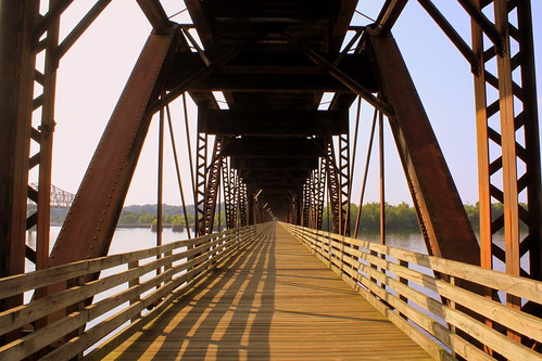
In 1990, a preservation society began in an effort to restore the bridge. The old railroad bed leading to the upper portion of the bridge now has a large gate in front of it, so you can look across it, but go no further. Down below, the access area was cleaned up and the wood that had been rotting for over 50 years was replaced. Today, this lower deck is a pedestrian bridge where you can walk about 1500 feet to where the segment is missing, and then you have to turn around.
Finally, the Library of Congress has some photos of this bridge dating back to 1976
www.loc.gov/pictures/search/?q=Photograph:%20al1320&f...
Tuesday, July 26, 2016
In the news: Eggner's Ferry Bridge demolished
The Eggner's Ferry Bridge, which crosses Kentucky Lake (and the Tennessee River) at Land Between the Lakes, has been demolished by KyDOT. You can see video of it here:
http://www.wsmv.com/story/32523095/crews-demolish-old-eggners-ferry-bridge-in-ky
This old bridge made national headlines in January 2012 when a boat crashed into this bridge, causing one of the spans to fall down. The bridge that opened in 1932 and carries US68 across the Tennessee River and Kentucky Lake has since reopened but is in the process of being replaced. You can read more about the incident here: en.wikipedia.org/wiki/Eggner%27s_Ferry_Bridge#January_201...
When looking at the photos from summer 2014, it's easy to spot the replacement truss. KYDOT was already starting construction on the replacement then. Here is a video of me driving over all of the Land Between the Lakes bridges: www.youtube.com/watch?v=DsUjtvvqyNs
Labels:
Bridge,
in the news,
Kentucky,
Land Between the Lakes,
Tennessee River,
US68
Sunday, July 10, 2016
Market Street Bridge (Just Before Sundown)
Saturday, April 2, 2016
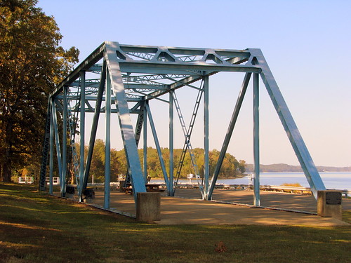
Scott Fitzhugh Bridge - Paris Landing, TN
The Scott Fitzhugh Bridge was built in 1927 to cross the Tennessee River (aka Kentucky Lake) at Paris Landing. when the bridge became Structurally Deficient, it was replaced in 1992 by the Ned McWherter Bridge. Thankfully, TDOT didn't feel the need to totally demolish the main span and it was converted to this pavilion at Paris Landing with the river in the background.
When this bridge was in use, it carried highway US79 (TN76) over the river and connected Henry and Stewart County. It was a Warren (Camelback) Through truss with a total length of 4,734 ft. You can see some vintage photos HERE at the Library of Congress website for the Historic American Engineering Record. Scott Fitzhugh was a former state Speaker of the House from Paris and the old road sign with his name was preserved along with this span.
Labels:
Bridge,
Henry County,
Paris,
state park,
Tennessee River,
US79
Monday, January 25, 2016
Norfolk Southern Tennessee River Bridge - Knoxville
Located in downtown Knoxville, this railroad bridge now used by Norfolk Southern has elements dating back to the Civil War, but has been rebuilt several times.
The stone piers and approaches are the oldest element of the bridge, dating back to the 1850s. Wooden spans were completed in 1867. In 1903, wooden spans were replaced with a steel trestle. It underwent a major rebuild in 1940. A tugboat hit one of the piers in 1993 and that pier was fortified. The center span of the bridge is a Pratt through truss and the other segments are Warren deck trusses.
The original builder of the bridge was Knoxville & Charleston Railroad which chartered in 1852. In the 1870s, they became the Knoxville & Augusta Railway. In 1890, they were bought out by East Tennessee, Virginia and Georgia Railway. Then, in 1894 they were bought out by Southern Railway.
Labels:
Bridge,
Knoxville,
Norfolk Southern,
Tennessee River
Thursday, November 19, 2015
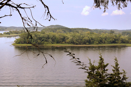
Hiwassee Island - Meigs County, TN
Hiwassee Island was the second largest in the Tennessee River until the 1940s when the TVA flooded part of the 781 acre island with the formation of the Chickamauga Dam Lake. The island is located in Meigs County at the confluence where the Hiwassee River meets the Tennessee River.
The island has been nominated for listing on the National Register of Historic Places. Archaeological artifacts dug from the island dates back to historic and prehistoric tribal peoples that lived on the island dating back to the late Woodland Hamilton phase (ca. A.D. 600-900), early Mississippian Hiwassee (ca. 1000-1300) and late Mississippian (ca 1000-1500).
The Cherokees which were the last tribe on the island left in 1818. The island is also called Jolly's Island named for Chief John Jolly. As a young boy Sam Houston lived on the island with the Cherokees. Chief Jolly adopted Sam and gave him an Indian name "The Raven." Possibly, this early influence guided his ambitions to settle the state of Texas. Will Rogers was another person of note that descended from the Rogers Family that lived on the island.
Today, the island is the Hiwassee Wildlife Refuge, serving as the home for many species including eagle and osprey. It is the staging ground for thousands of migrating Sandhill Cranes from November to February. This photo is taken from an observation deck atop a river bluff at the Cherokee Removal Memorial Park. It is a popular observation spot for birdwatchers, especially when the cranes come through.
Thursday, November 5, 2015
In the News: Ten in Tenn: Blair's Ferry Storehouse - Loudon, TN
A few days ago, the Tennessee Preservation Trust released their 2015 list of endangered historical sites in the state. This week on the blog, we are talking about some of the properties on this list. Here is how TPT describes the list:
"The Tennessee Preservation Trust’s Ten in Tennessee Endangered Properties List Program is TPT’s strongest advocacy tool for the state’s most endangered historic sites. Each year, TPT seeks nominations for the “Ten in Tenn” from the public from each of Tennessee’s nine Development Districts."
You can also see past entries on their website here:
http://www.tennesseepreservationtrust.org/ten-in-tn/?ref=archive
From TPT:
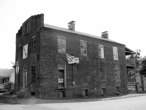
The Blair’s Ferry Storehouse is one of the oldest remaining commercial buildings in East Tennessee and one of the regions’ earliest surviving examples of a structure built specifically as a warehouse. Built in 1835, the property is reflective of the early 19th century commerce along the Tennessee River. It was listed on the National Register in 1977 and much of the building’s architectural character remains intact. However, the current owner has limited funds to maintain the building and it is succumbing to deterioration and neglect.
For more info, see this wikipedia article.
Labels:
ferry,
in the news,
Loudon,
Loudon County,
Ten in Tenn,
Tennessee River
Wednesday, March 18, 2015
Chattanooga's Icarus
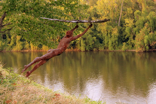
This carved metal statue is located at the Bluff View Arts District in Chattanooga and overlooks the Tennessee River. The statue is by Russell Whiting and you can see his website here: www.whitingsculpture.com/
From Greek Mythology, Icarus with his wings was told to not fly too close to the sun or the wax on the wings would melt, yet did it anyway.
Tuesday, March 3, 2015
A Spot to See the Tennessee River Railroad Bridge - Chattanooga, TN
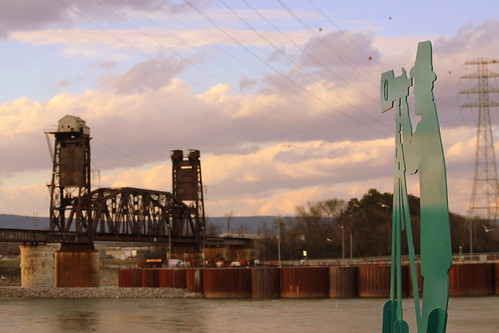
This bridge was built in 1920 and reused piers from an earlier bridge. The bridge was built by Cincinnati Southern Railway, which was owned by the city of Cincinnati. I believe the city still owns this bridge, and over they years they have leased its use to Southern and today Norfolk Southern. The main span is a lift bridge, and has been that way since 1920, but was a swing bridge in a previous time. The bridge is barely downstream from Chickamauga Dam, and while it still can lift, it doesn't happen too often anymore.
It is possible to see the bridge from either side of the Tennessee River. On the north side, you can see it while driving along TVA Access Road, although there's nowhere to park. On the south side, there is parking for the end of the Tennessee Riverwalk behind the Chattanooga State Community College
Saturday, January 3, 2015
Walnut Street Bridge at Night
The Walnut Street Bridge is a Six-span through truss bridge over the Tennessee River on Walnut Street. It opened in 1891 and is a length of 2,370 ft. The bridge was closed to auto traffic in 1978, sat in disrepair for about a decade and then was converted into one of the world's longest pedestrian bridges. Now, the bridge is on the National Register of Historic Places. This photo was taken from the deck of the Delta Queen.
Friday, December 5, 2014
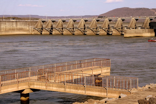
Nickajack Dam
Nickajack Dam is a TVA hydroelectric dam on the Tennessee River just upstream from Chattanooga.
Before the completion of Hales Bar Dam in 1913, the Tennessee River Gorge was one of the major impediments— along with Muscle Shoals and the Elk River shoals— to year-round navigation on the Tennessee River. Along with unpredictable water levels, the gorge was filled with numerous water hazards, some of which had been given nicknames such as "The Suck", "The Skillet", and "The Pan." In the early 1900s, the U.S. Army Corps of Engineers realized that a dam near the southwestern end of the gorge would flood the water hazards and eliminate the gorge's rapid downstream current. Chattanooga engineer Josephus Conn Guild offered to raise funds to build this dam in exchange for rights to the dam's electrical output. After receiving authorization from Congress in 1904, he organized the Chattanooga and Tennessee River Power Company (later TEPCO) in 1905, and the company began building Hales Bar Dam in October of that year. Hales Bar's weak limestone foundation — which hadn't been considered in the selection of the dam site— presented numerous obstacles from the outset, but the dam was finally completed in 1913.
In 1939, after a contentious court battle, TEPCO was forced to sell its assets— including Hales Bar Dam— to the Tennessee Valley Authority. The dam had been leaking since its construction, and TVA immediately initiated a series of foundation improvements that by 1943 had succeeded in halting the leaks. In 1960, however, the leaks had returned, spilling at an alarming 2,000 cubic feet per second. Around the same time, TVA began expanding locks on its dams to at least 600 feet to accommodate the increase in traffic the river had experienced since World War II, and it was determined that expanding the Hales Bar lock would be "prohibitively" expensive. Rather than spend the necessary expenses to upgrade Hales Bar, a decision was made in 1963 to build a new dam altogether on a more solid bedrock a few miles downstream.
The Nickajack Dam project was authorized January 9, 1964, and construction began April 1, 1964. Funding set aside for repair work on Hales Bar was transferred to the Nickajack project. The reservoir's construction— which basically involved extending the Hales Bar Reservoir 6 miles downstream to Nickajack— required the purchase of 8,300 acres, 500 acres of which had to be cleared. 82 families and 8 miles of roads had to be relocated. Two generators and several switchyard parts were moved from Hales Bar Dam to the new dam. Construction was completed on December 14, 1967, at a cost of $73 million. Operations at Hales Bar Dam were halted the following day, and by September 1968, Hales Bar Dam had been dismantled and its reservoir merged with Nickajack Lake.
Labels:
dam,
Marion County,
Nickajack Lake,
Tennessee River
Saturday, November 22, 2014
Norfolk Southern Tennessee River Bridge - Knoxville
Located in downtown Knoxville, this railroad bridge now used by Norfolk Southern has elements dating back to the Civil War, but has been rebuilt several times.
The stone piers and approaches are the oldest element of the bridge, dating back to the 1850s. Wooden spans were completed in 1867. In 1903, wooden spans were replaced with a steel trestle. It underwent a major rebuild in 1940. A tugboat hit one of the piers in 1993 and that pier was fortified. The center span of the bridge is a Pratt through truss and the other segments are Warren deck trusses.
The original builder of the bridge was Knoxville & Charleston Railroad which chartered in 1852. In the 1870s, they became the Knoxville & Augusta Railway. In 1890, they were bought out by East Tennessee, Virginia and Georgia Railway. Then, in 1894 they were bought out by Southern Railway.
Labels:
Bridge,
Knoxville,
Tennessee River,
train tracks
Subscribe to:
Posts (Atom)