Home     Daily Blog     Galleries     Maps     Contact

Showing posts with label Scenic Overlook. Show all posts

Wednesday, April 20, 2022

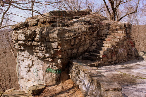
Big Rock & Scenic Overlook - Sewanee, TN

Big Rock & Scenic Overlook - Sewanee, TN

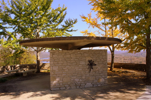
In the earliest days of cross country automobile travel, there weren't as many places to pull over and rest, so the early highway departments would add scenic stops with several parking spaces and concrete picnic tables. This would be even more important for the winding drive up a mountain, especially if it was a new or scary experience.

One of the earliest routes to ascend the Cumberland Plateau in the Monteagle area connected Sewanee at the top to Cowan down below. As the members of the Dixie Highway Association were looking for the best route to cross the plateau, they decided to reuse this early road, making improvements along the incline.

A more detailed description of this spot comes from the TDOT book Tennessee's Survey Report for Historic Highway Bridges on Page 125:
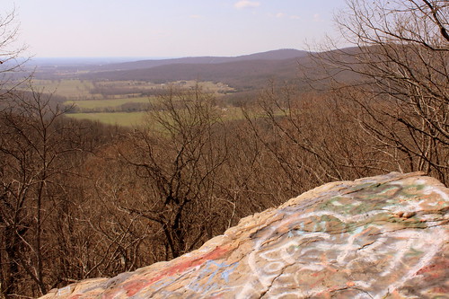
During the 1920s and 1930s, there was a growing interest nationally in scenic beautification projects along highways. These often included turnouts, or pull-offs, sometimes with small parks or picnic areas. If an impressive view existed, the turnout was called a scenic overlook. During the 1930s, beginning in 1934 in Tennessee, federal relief programs funded “Roadside Development,” “Landscaping,” and “Beautification” projects resulting in landscaping projects and a variety of roadside parks, pull-offs or turnouts, and overlooks. An example is the scenic overlook on the steep western side of Monteagle Mountain. In 1918 Franklin County issued a $300,000 bond issue for road improvements which included a joint project with the state in 1919 to improve a ten mile stretch of the Dixie Highway through the county that contained this pull-off. It is unknown if the original pull-off, which contained a sweeping 400 foot stone wall flanking a massive boulder, pre-dates the 1919 project or if it was built (or enhanced) as part of the project. In 1936 the state spent $11,190 as a National Recovery Highway Project to landscape 5.4 miles of the Cowan to Sewanee section of State Route 15 (the Dixie Highway). The 1936 project, whose plans show the location of the original stone wall, removed the older wall and erected a new wall of rubble masonry 1400 feet long, cut steps into the boulder (7” rise, 12” tread, and 30” width), and paved the parking area with macadam stone. The state also built over 900 discontiguous feet of rubble masonry walls and planted over 2100 trees and shrubbery “grouped in as natural arrangements as possible” on the project.

While the road was originally part of the Dixie Highway, and then state route TN15, eventually it became US41A/US64. (It is not US64 anymore as that route now meets I-24 and ascends Monteagle that way.) This area is right along the western edge of the Domain of the University of the South. The stone masonry that extends from the left of the boulder eventually meets up with the highway marking the western entrance of the University of the South. When you climb up the steps, you see the surface of the boulder is covered with graffiti covering graffiti. My personal favorite was "Don't fall of and die!!!" (Things dating back to the Thirties don't always have guardrails.) Even still, in the 10 minutes I was here, multiple carloads of young and old passengers stopped for family portraits.

Monday, October 11, 2021

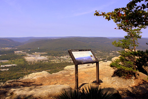
The View From Sunset Rock - Lookout Mtn., TN

The View From Sunset Rock - Lookout Mtn., TN

Sunset Rock is a stone formation on the west side of Lookout Mountain (Hence, the side where the sun sets) near Chattanooga, TN. The marker in the picture discusses the Civil War significance, and how generals here could overlook fighting in the valley below. The strait rock face also makes this a popular spot for rock climbing and rappelling.

To get here, there a tiny parking area atop lookout mountain, and then a short (.2 mi.) but steep descent to the bluff. Just as many places in nature, there's nothing to keep you from going over the cliff, so caution should be used.

Sunday, August 22, 2021

Fathers' Memorial & Overlook - Fayetteville, TN

Fathers' Memorial & Overlook - Fayetteville, TN

Fathers' Memorial & Overlook is a part of Stone Bridge Park in Fayetteville, TN. This area overlooks the Elk River close to where Norris Creek joins.

This may be a lesser-known feature of Stone Bridge Park as you have to take a paved trail which goes under the US64 bridge.

Sunday, March 21, 2021

View of Downtown Knowville from Fort Dickerson Park

View of Downtown Knowville from Fort Dickerson Park

While it's not a great view, it's still an interesting view - and you can't see it at all most of the year. Fort Dickerson Park located south of downtown is a Civil War Battlefield atop a tall hill and includes this scenic overlook.

Monday, September 4, 2017

Tater Knob Scenic Overlook

View of Cordell Hull Lake from Tater Knob

Happy Labor Day! Here's a scenic overlook that you can visit today.

Tater Knob Scenic Overlook

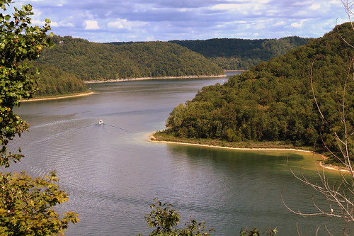
Tater Knob is a mountain in Smith County. At the top is an observation deck which provides a scenic overlook of Cordell Hull Lake and Dam.

Telephoto View of Cordell Hull Lake from Tater Knob

Cordell Hull Dam (View from Bearwaller Gap Overlook)

According to Wikipedia:
Cordell Hull Lake is a lake in the Cumberland River in north-central Tennessee, about forty miles east of Nashville, in the vicinity of Carthage. It covers approximately 12,000 acres.

Cordell Hull Dam impounding the Cumberland River was built by the United States Army Corps of Engineers between May 1963 and November 1973 for navigation, hydroelectric power generation, and recreation. The dam is concrete and earthen gravity structure, 87 feet high (above streambed), with a generator capacity of 100 megawatts. It impounds 259,100 acre feet at normal maximum pool, with a maximum flood storage of 310,900 acre feet.

Both are named for Cordell Hull, former United States Secretary of State.

Thursday, March 30, 2017

Big Rock & Scenic Overlook - Sewanee, TN

Big Rock & Scenic Overlook - Sewanee, TN

In the earliest days of cross country automobile travel, there weren't as many places to pull over and rest, so the early highway departments would add scenic stops with several parking spaces and concrete picnic tables. This would be even more important for the winding drive up a mountain, especially if it was a new or scary experience.

One of the earliest routes to ascend the Cumberland Plateau in the Monteagle area connected Sewanee at the top to Cowan down below. As the members of the Dixie Highway Association were looking for the best route to cross the plateau, they decided to reuse this early road, making improvements along the incline.

A more detailed description of this spot comes from the TDOT book Tennessee's Survey Report for Historic Highway Bridges on Page 125:
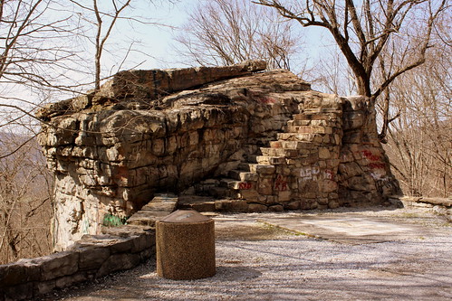
During the 1920s and 1930s, there was a growing interest nationally in scenic beautification projects along highways. These often included turnouts, or pull-offs, sometimes with small parks or picnic areas. If an impressive view existed, the turnout was called a scenic overlook. During the 1930s, beginning in 1934 in Tennessee, federal relief programs funded “Roadside Development,” “Landscaping,” and “Beautification” projects resulting in landscaping projects and a variety of roadside parks, pull-offs or turnouts, and overlooks. An example is the scenic overlook on the steep western side of Monteagle Mountain. In 1918 Franklin County issued a $300,000 bond issue for road improvements which included a joint project with the state in 1919 to improve a ten mile stretch of the Dixie Highway through the county that contained this pull-off. It is unknown if the original pull-off, which contained a sweeping 400 foot stone wall flanking a massive boulder, pre-dates the 1919 project or if it was built (or enhanced) as part of the project. In 1936 the state spent $11,190 as a National Recovery Highway Project to landscape 5.4 miles of the Cowan to Sewanee section of State Route 15 (the Dixie Highway). The 1936 project, whose plans show the location of the original stone wall, removed the older wall and erected a new wall of rubble masonry 1400 feet long, cut steps into the boulder (7” rise, 12” tread, and 30” width), and paved the parking area with macadam stone. The state also built over 900 discontiguous feet of rubble masonry walls and planted over 2100 trees and shrubbery “grouped in as natural arrangements as possible” on the project.

While the road was originally part of the Dixie Highway, and then state route TN15, eventually it became US41A/US64. (It is not US64 anymore as that route now meets I-24 and ascends Monteagle that way.) This area is right along the western edge of the Domain of the University of the South. The stone masonry that extends from the left of the boulder eventually meets up with the highway marking the western entrance of the University of the South. When you climb up the steps, you see the surface of the boulder is covered with graffiti covering graffiti. My personal favorite was "Don't fall of and die!!!" (Things dating back to the Thirties don't always have guardrails.) Even still, in the 10 minutes I was here, multiple carloads of young and old passengers stopped for family portraits.

Saturday, March 18, 2017

Harold Lambert Overlook - Fort Dickerson Quarry

Harold Lambert Overlook - Fort Dickerson Quarry

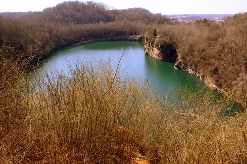
This scenic spot not far from downtown Knoxville might be well known to the locals, but was a surprise for an out-of-towner like me. The water is so green, I should have posted this for St. Patrick's Day yesterday.

Several times over the years, I would pass through Knoxville along the Chapman Highway on the way to Gatlinburg. Not far after crossing the Tennessee River, I would see the steep drive on the west side of the road pointing up to Fort Dickerson. I often wondered what was up there, but I always forgot to research it further because I was on my way to Gatlinburg. In recent years, Knoxville, has made the road up there a little less steep, and more inviting.

In addition to the actual Civil War Fort Dickerson atop this small mountain, is this scenic overlook to the Fort Dickerson Quarry (aka Lambert Quarry). Now that water has filled into the quarry, it has turned into this emerald green color.

Not far from the Fort is Lambert Overlook. All one can do here is take a look as the city has installed some fencing to prevent people from trying to access the water from this side. You may be able to tell there is a road that leads down to the water on the other side.

For many years, the locals wanted this to be a swimming hole - a place of calm water so close to downtown. It was illegal for a long time, but a couple of years ago the city made it ok to swim here. However, swimming has it's risks as you choose to swim to the other side and get tired, you have to swim all the way back to where you started as there is only one place to enter and exit. Plus there have been a few people who made poor decisions and lost their life when jumping from the bluffs. This has forced the city to reconsider whether or not swimming should be permitted here.

Thursday, February 16, 2017

View of Cordell Hull Lake from Tater Knob

View of Cordell Hull Lake from Tater Knob

Tater Knob is a mountain in Smith County. At the top is an observation deck which provides a scenic overlook of Cordell Hull Lake and Dam.

Thursday, February 25, 2016

Big Rock & Scenic Overlook - Sewanee, TN

Big Rock & Scenic Overlook - Sewanee, TN

In the earliest days of cross country automobile travel, there weren't as many places to pull over and rest, so the early highway departments would add scenic stops with several parking spaces and concrete picnic tables. This would be even more important for the winding drive up a mountain, especially if it was a new or scary experience.

One of the earliest routes to ascend the Cumberland Plateau in the Monteagle area connected Sewanee at the top to Cowan down below. As the members of the Dixie Highway Association were looking for the best route to cross the plateau, they decided to reuse this early road, making improvements along the incline.

A more detailed description of this spot comes from the TDOT book Tennessee's Survey Report for Historic Highway Bridges on Page 125:
During the 1920s and 1930s, there was a growing interest nationally in scenic beautification projects along highways. These often included turnouts, or pull-offs, sometimes with small parks or picnic areas. If an impressive view existed, the turnout was called a scenic overlook. During the 1930s, beginning in 1934 in Tennessee, federal relief programs funded “Roadside Development,” “Landscaping,” and “Beautification” projects resulting in landscaping projects and a variety of roadside parks, pull-offs or turnouts, and overlooks. An example is the scenic overlook on the steep western side of Monteagle Mountain. In 1918 Franklin County issued a $300,000 bond issue for road improvements which included a joint project with the state in 1919 to improve a ten mile stretch of the Dixie Highway through the county that contained this pull-off. It is unknown if the original pull-off, which contained a sweeping 400 foot stone wall flanking a massive boulder, pre-dates the 1919 project or if it was built (or enhanced) as part of the project. In 1936 the state spent $11,190 as a National Recovery Highway Project to landscape 5.4 miles of the Cowan to Sewanee section of State Route 15 (the Dixie Highway). The 1936 project, whose plans show the location of the original stone wall, removed the older wall and erected a new wall of rubble masonry 1400 feet long, cut steps into the boulder (7” rise, 12” tread, and 30” width), and paved the parking area with macadam stone. The state also built over 900 discontiguous feet of rubble masonry walls and planted over 2100 trees and shrubbery “grouped in as natural arrangements as possible” on the project.

While the road was originally part of the Dixie Highway, and then state route TN15, eventually it became US41A/US64. (It is not US64 anymore as that route now meets I-24 and ascends Monteagle that way.) This area is right along the western edge of the Domain of the University of the South. The stone masonry that extends from the left of the boulder eventually meets up with the highway marking the western entrance of the University of the South. When you climb up the steps, you see the surface of the boulder is covered with graffiti covering graffiti. My personal favorite was "Don't fall of and die!!!" (Things dating back to the Thirties don't always have guardrails.) Even still, in the 10 minutes I was here, multiple carloads of young and old passengers stopped for family portraits.

Saturday, October 24, 2015

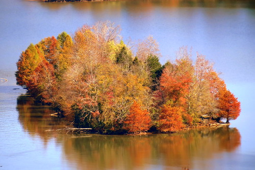
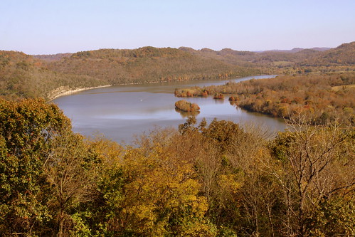
Cordell Hull Dam in Autumn (View from Bearwaller Gap Overlook)

Cordell Hull Dam (View from Bearwaller Gap Overlook)

According to Wikipedia:
Cordell Hull Lake is a lake in the Cumberland River in north-central Tennessee, about forty miles east of Nashville, in the vicinity of Carthage. It covers approximately 12,000 acres.

Cordell Hull Dam impounding the Cumberland River was built by the United States Army Corps of Engineers between May 1963 and November 1973 for navigation, hydroelectric power generation, and recreation. The dam is concrete and earthen gravity structure, 87 feet high (above streambed), with a generator capacity of 100 megawatts. It impounds 259,100 acre feet at normal maximum pool, with a maximum flood storage of 310,900 acre feet.

Both are named for Cordell Hull, former United States Secretary of State.

Tuesday, March 10, 2015

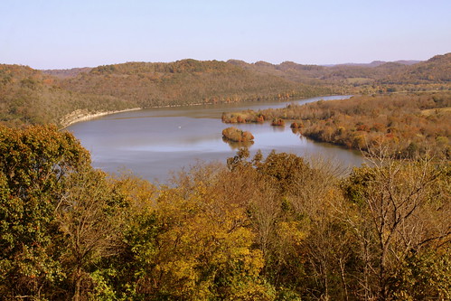
Center Hill Lake from TN56 Scenic Overlook

Center Hill Lake from TN56 Scenic Overlook

Highway TN56 connects Smithville to Cookeville and crosses through the hills around Center Hill Lake. In DeKalb County, TN56 crosses the Lake at Hurricane Bridge, and about a mile north of there has this scenic overlook of the Lake and Caney Fork River.