The Daily blog of SeeMidTN.com, pictures from Middle Tennessee and nearby cities.
Friday, February 26, 2016
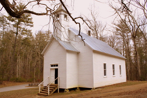
Fentress Co Historical Society Museum \ Bruno Gernt Office
Allardt, TN - Listed on the National Register of Historic Places, today serving as the Local Historical Society. Also, the sign for the Museum also uses my picture. See it here: flic.kr/p/oETF3K
In the late 1800s, Gernt and M. H. Allardt founded a community of immigrant Germans in the Upper Cumberland Plateau at about the same time the British were settling nearby (and today the much more famous) Rugby. German land agent Bruno Gernt envisioned a self-sufficient city here. Gernt sold 9,000 acres owned by the Clarke family of Nebraska in parcels of 25,50, and 200 acres at $4 per acre to farmers, miners, and lumbermen.
The town was laid out geometrically and named for Gernt's partner, M. H. Allardt, who died before settlement began. Gernt recruited skilled craftsmen, professionals, and experienced farmers from Germany, and soon Allardt led the region in production of hay, fruits, and vegetables. For more than 50 years, Gernt never ceased his efforts to have the town of Allardt be all he dreamed it could be, and the community prospered for a time. Today, more than a dozen buildings make up the Allardt Historic District.
Thursday, February 25, 2016
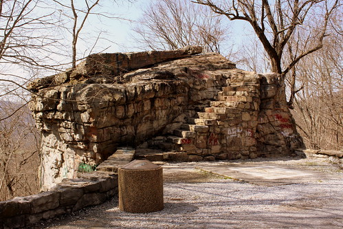
Big Rock & Scenic Overlook - Sewanee, TN
In the earliest days of cross country automobile travel, there weren't as many places to pull over and rest, so the early highway departments would add scenic stops with several parking spaces and concrete picnic tables. This would be even more important for the winding drive up a mountain, especially if it was a new or scary experience.
One of the earliest routes to ascend the Cumberland Plateau in the Monteagle area connected Sewanee at the top to Cowan down below. As the members of the Dixie Highway Association were looking for the best route to cross the plateau, they decided to reuse this early road, making improvements along the incline.
A more detailed description of this spot comes from the TDOT book Tennessee's Survey Report for Historic Highway Bridges on Page 125:
During the 1920s and 1930s, there was a growing interest nationally in scenic beautification projects along highways. These often included turnouts, or pull-offs, sometimes with small parks or picnic areas. If an impressive view existed, the turnout was called a scenic overlook. During the 1930s, beginning in 1934 in Tennessee, federal relief programs funded “Roadside Development,” “Landscaping,” and “Beautification” projects resulting in landscaping projects and a variety of roadside parks, pull-offs or turnouts, and overlooks. An example is the scenic overlook on the steep western side of Monteagle Mountain. In 1918 Franklin County issued a $300,000 bond issue for road improvements which included a joint project with the state in 1919 to improve a ten mile stretch of the Dixie Highway through the county that contained this pull-off. It is unknown if the original pull-off, which contained a sweeping 400 foot stone wall flanking a massive boulder, pre-dates the 1919 project or if it was built (or enhanced) as part of the project. In 1936 the state spent $11,190 as a National Recovery Highway Project to landscape 5.4 miles of the Cowan to Sewanee section of State Route 15 (the Dixie Highway). The 1936 project, whose plans show the location of the original stone wall, removed the older wall and erected a new wall of rubble masonry 1400 feet long, cut steps into the boulder (7” rise, 12” tread, and 30” width), and paved the parking area with macadam stone. The state also built over 900 discontiguous feet of rubble masonry walls and planted over 2100 trees and shrubbery “grouped in as natural arrangements as possible” on the project.
While the road was originally part of the Dixie Highway, and then state route TN15, eventually it became US41A/US64. (It is not US64 anymore as that route now meets I-24 and ascends Monteagle that way.) This area is right along the western edge of the Domain of the University of the South. The stone masonry that extends from the left of the boulder eventually meets up with the highway marking the western entrance of the University of the South. When you climb up the steps, you see the surface of the boulder is covered with graffiti covering graffiti. My personal favorite was "Don't fall of and die!!!" (Things dating back to the Thirties don't always have guardrails.) Even still, in the 10 minutes I was here, multiple carloads of young and old passengers stopped for family portraits.
Labels:
Cumberland Plateau,
Dixie Highway,
Franklin County,
roadfan,
roadgeek,
rock,
Scenic Overlook,
Sewanee,
US41A,
US64
Wednesday, February 17, 2016
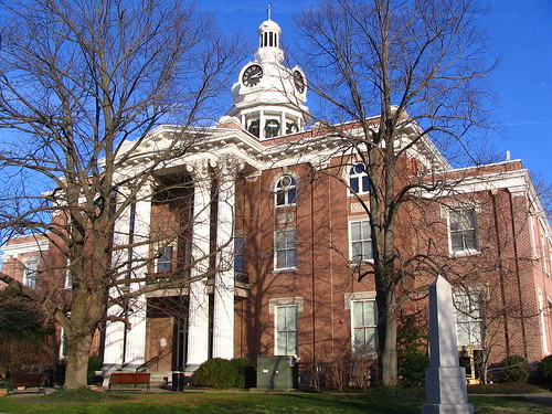
Rutherford County Courthouse in winter
Several years ago, I got the book Tennessee Taproots which is a 40 year old book about all of the county courthouses in Tennessee. Looking at the photo of this in the book, the 2 big trees in this picture were considerably shorter. I've had experiences shared with others that it's impossible to get a good view of the building unless you don't get the whole building or you bring a chainsaw.
The obelisk in the foreground was placed by the state of Tennessee marking every state capitol before Nashville.
Friday, February 12, 2016
Berry's Loan Pawnbroker neon sign - Downtown Nashville
I'm not completely sure about this, but I think this is now gone. I believe it used to be located on 4th Ave. in downtown Nashville near the entrance to the Arcade.
Thursday, February 11, 2016
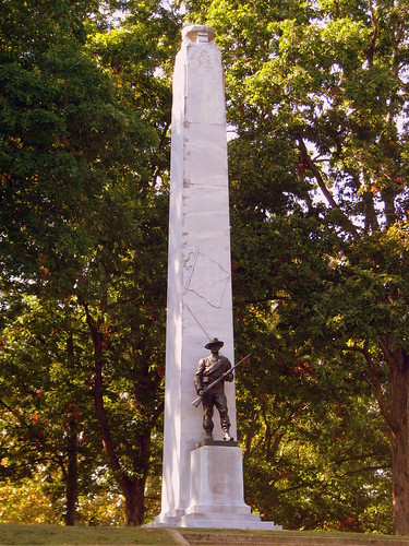
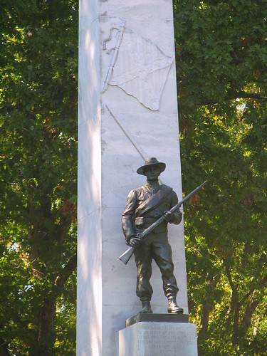
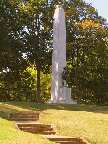
Confederate Monument at Fort Donelson
According to the text etched at the base:
This shaft is dedicated as an altar of remembrance to the Confederate Soldiers who fought at Fort Donelson February, 1862
by the Daughters of the Confederacy
Labels:
civil war,
Confederate,
Fort Donelson,
monument,
Stewart County
Wednesday, February 10, 2016
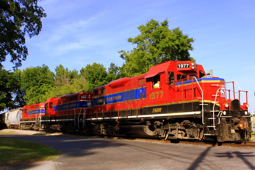
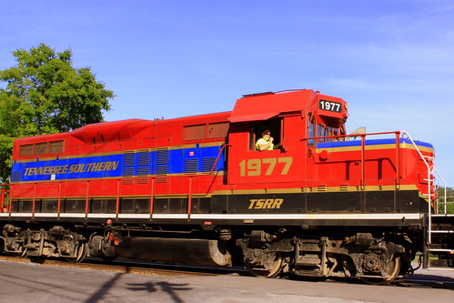
Tennessee Southern Railroad Locomotive - Loretto, TN
A few years ago, Tennessee Southern was what made me learn about Short Line railroads. I was in Columbia, TN and I saw a red and blue train coming my way, and I was perplexed to see anything other than CSX. Then I saw the name Tennessee Southern and I wondered if it was some weird holdover hybrid of the old Tennessee Central and the Southern Railway. It wasn't. It's a short line.
Tennessee Southern is today owned by Patriot Rail Corporation, and this photo was taken where the train runs through Loretto, TN - a small town in Lawrence County.
Their website explaines where they run today.
www.tennesseesouthern.com/aboutus1.htm
"The Tennessee Southern Railroad began operation in July of 1988 on former Norfolk Southern track in Florence, Alabama. On February 1, 1989, the TSR began operation on the former CSX Transportation track running from just north of Columbia, Tennessee to Pulaski, Tennessee on the old N & D (Nashville and Decatur) Main from Columbia, Tennessee to Florence, Alabama on the old NF&S (Nashville, Florence and Sheffield) Main. The TSR interchanges rail traffic with CSX Transportation at Natco, Tennessee located just north of Columbia, Tennessee. Additionally, we interchange with all inland barge lines through our Port Facility at Florence, Alabama, where we transfer freight to or from barge traffic on the Tennessee River."
Tuesday, February 9, 2016
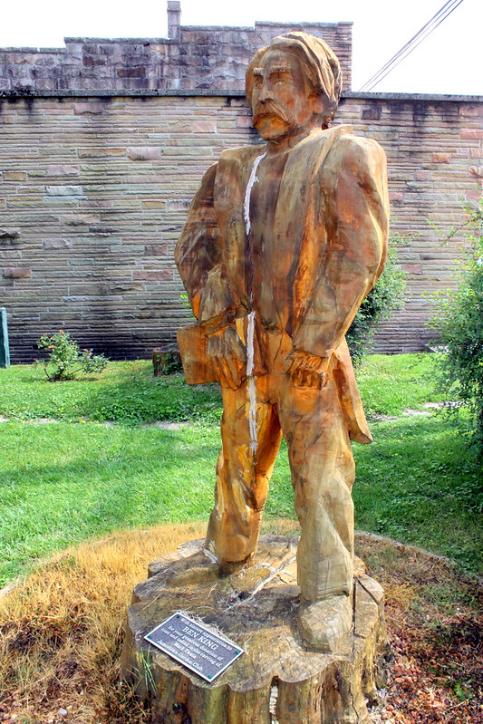
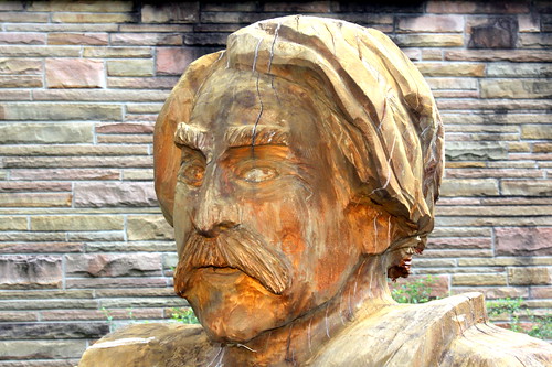
Mark Twain Chainsaw Carving - Jamestown, TN
The parents of Samuel Clemens (better known by the pseudonym Mark Twain) lived in Jamestown before he was born. About a block from the town square is Mark Twain Park which also contains the town spring.
A new addition to the park since the last time I was in Jamestown in 2009 is this statue of Twain. This artwork was donated to the Jamestown Garden Club by Master of the Chainsaw Ben King. (Yes, this was carved by a chainsaw. If you've never seen a chainsaw artist do their thing, it's amazing the fine details that can be done with one. I'd be lucky to make a straight line with a chainsaw.)
Labels:
Fentress County,
Jamestown,
Mark Twain,
statue
Monday, February 8, 2016
Music City's Microphone Bike Rack
Located along Nashville's Music Row, this public street art microphone doubles as a bicycle rack. “Microphone Rack” by Franne Lee, Keith Harmon and Mac Hill of Nashville, is located at the northeast corner of Demonbreun Street and Music Row. The rack, made of stainless steel in 2010, represents Nashville’s history as a communications, broadcasting and music center. My favorite detail is the audio jack that plugs into the ground.
Sunday, February 7, 2016
Cades Cove Missionary Baptist Church (Corner View)
Cades Cove at the Great Smoky Mountains National Park is the most popular destination in the United States most visited national park. The isolated valley was the home to many early settlers and today several of those sites are well preserved. An 11-mile, one-way loop road circles the cove, offering motorists the opportunity to sight-see the wildlife, scenic beauty and historic district structures on the National Register of Historic Places at a leisurely pace.
The Baptist denomination came to Cades Cove in 1825. Several years later that congregation split into the Primitive Baptist Church and this Missionary Baptist Church. (the sign on the side of the building says they were founded in 1839.) They met together at first in homes in 1841. They stopped meeting during the Civil War. They grew large enough to need a building, which was completed in 1894. As they continued to grow, they needed a bigger building and this one was completed in 1915.
Labels:
Blount County,
Cades Cove,
church,
Smokey Mountains
Saturday, February 6, 2016
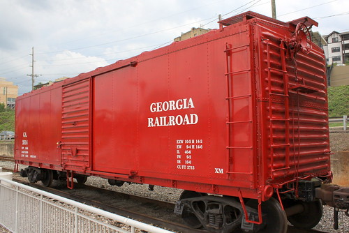
Georgia Railroad Boxcar #2614 - Knoxville, TN
Friday, February 5, 2016
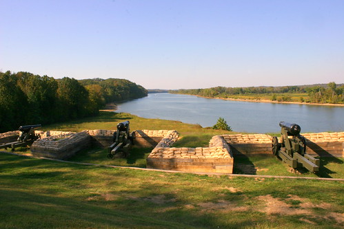
Fort Donelson Battery - Dover, TN
During the Civil War, the Confederacy was vulnerable to warships coming down the Tennessee and Cumberland rivers. Kentucky declared neutrality during the war, so the Confederates looked for a place near the the border where they could defend the river. About a mile north of Dover and about 10 miles downstream along the Cumberland River from the Kentucky Border was the site of this fort. At this location, the river has a lengthy strait path before a bend and the bluffs above the river provided a great location for a battery to shoot down any Union boat that would try to come through. In Feb. 1862, Union General Ulysses S. Grant led troops to capture this fort so that the Union could send ships through here.
When I was in 6th grade, my class visited this spot on the way to an overnight stay at Land Between the Lakes and it's something that has stuck in my mind over two decades later.
Today with a dam upstream, the Cumberland River is also Lake Barkley, but the width of the waterway is about the same as it was during the war. Fort Donelson is under the oversight of the National Park Service and is designated a National Battlefield and on the National Register of Historic Places. The lower batteries have been rebuilt and preserved here. The Upper batteries are also preserved and is located around the bend. The cannon shown here has a date of 1846 etched in the side.
Labels:
Cannon,
civil war,
Cumberland River,
Dover,
Fort Donelson,
Stewart County
Thursday, February 4, 2016
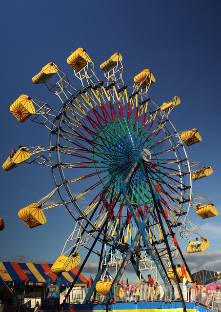
2013 Coffee Co. Fair: Astro Wheel in the Day
For the photo shown here, the ferris wheel was photographed during the day, although during the "golden hour" close to an hour before sundown. For this photo, I have attached a variable neutral density filter to my camera, which explains the contrast in sky color from one side to the other (a Variable ND filter is two polarizers together, and depending on how it is set can be anywhere from an ND1 to ND64. Mine was positoned close to ND16 for this photo.) For the photos with the wheel in motion, I attempted a daytime blurred motion ferris wheel photo, which doesn't appear to have been tried very often.
In 2013, the Coffee County Fair in Manchester, TN had a midway provided by Kissel Rides and Shows. This is the text of the info marker at the Astro Wheel:
In 1967 the Astro Wheel was designed by Chance Manufacturing, and was built in their Witchita, Kansas facility in 1967. Only nine were ever made. The Astro Wheel was unpopular with Carnival owners of that era, due to the fact, the ride required multiple trailers to transport and the excessive amount of man-hours to assemble the seventy-three foot tall device. Only four are still known to be in existence.
This particular Astro Wheel is believed to be the first one ever manufactured. It was found in a closing amusement park and was headed for certain destruction. Purchased by Kissel Rides and Shows, in 1995, our Astro Wheel quickly became a Midway favorite. Although, 2004 brought about a sad change for the massive ride. The owner at that time decided to retire the machine and replace it with a smaller, more portable wheel. The unique amusement device was once again rescued when Kissel Rides and Shows was purchased in 2005. The new owners set things in motion to not only use the wheel, but to totally restore it to pristine condition.
Fast Facts:
1967 year of manufacture
73 feet tall
2 semi trailers to transport
6 men to assemble
65 kilowatts to power
750-800 passengers per hour
2009 year of renovation
6051 individual lights
153 gallons of paint
2 miles of electrical wire
6 tons of sandblast sand
$100,000
Please enjoy yourself while riding an American Classic.....
The Mighty Giant Astro Wheel
To see all my Astro Wheel photos, look here:
www.flickr.com/photos/brent_nashville/tags/astrowheel/
Labels:
Coffee County,
county fair,
ferris wheel,
Manchester,
midway
Wednesday, February 3, 2016
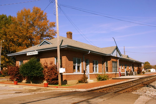
Newbern, TN IC Depot
There are two Amtrak stops in Tennessee. One is in Memphis and the other is in the tiny West Tennessee town of Newbern. The brick passenger station was built by Illinois Central in 1920 as part of the "City of New Orleans" route. It is listed on the National Register of Historic Places.
Illinois Central passenger train service to the depot ceased in 1965. The building was then used for storage until 1990, when it was acquired by the city of Newbern. It was subsequently restored based on the original architectural drawings. The building now houses the Amtrak stop and a small museum of railroad history that exhibits old photos, railroad tools, uniforms, schedules, and other memorabilia, along with model trains and art work. The depot is a central feature of Newbern's "Depot Days" Festival, held annually in September.
Tuesday, February 2, 2016
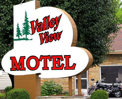
Valley View Motel - Celina, TN
Valley View Motel is located along Lake Ave. in Celina. While it's not a major road out of town anymore, I believe the road is an old alignment of highway TN53. Despite not being on a major highway, it's still in business, so I guess they're doing something right. Normally, I only upload the older signs with the neon tubes still intact, but I thought this place looked nice.
Monday, February 1, 2016
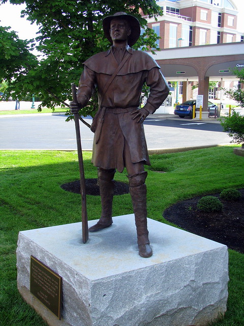
Clarksville: John Montgomery statue
Subscribe to:
Posts (Atom)