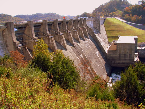
On the Caney Fork River. Built in 1949 and operated by the Army Corps of Engineers.
As explained on the plaque: "This is one of a series of dams in the Cumberland River Basin for flood control, power, navigation and water conservation.
Height - 240 ft.
Length - 2,160 ft.
Crest of Spillway - EL.646
Top of dam - El. 696
Resevoir capacity at max pool - 2,092,000 ac.ft.
Reservoir area at max. pool - 23,060 acres
Shore line - 415 miles
concrete - 960,000 Co.yds.
Earth Embankment - 2,600,00 cu.yds.
In January 2007, the U.S. Army Corps of Engineers placed Center Hill Dam under a high risk for failure. Highway TN96 also crosses over the top of the dam.
No comments:
Post a Comment