Home     Daily Blog     Galleries     Maps     Contact

Showing posts with label South Cumberland State Park. Show all posts

Saturday, November 16, 2013

Lone Rock Coke Ovens

Lone Rock Coke Ovens

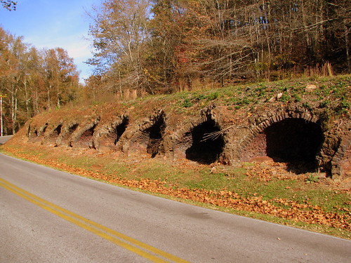
The Tennessee Coal and Iron Company in 1883 built 120 coke ovens to help supply its growing iron works. The company contracted with the state, and convicts worked the ovens until 1896. The coke was sent to be used by the steel industry around South Pittsburg, TN. On August 13, 1892, Tracy City miners, who opposed the use of convict labor, burned the stockades and put the convicts on a train and sent them back to Nashville. (This had also been done a year earlier in Anderson County, TN.)

These Coke ovens are viewable near Tracy City at Grundy Lake, which is part of the South Cumberland State Park. Today it is listed on the National Register of Historic Places as part of the Grundy Lakes Historic District.

Friday, October 28, 2011

Sewanee Natural Bridge

Sewanee Natural Bridge

From Wikipedia:

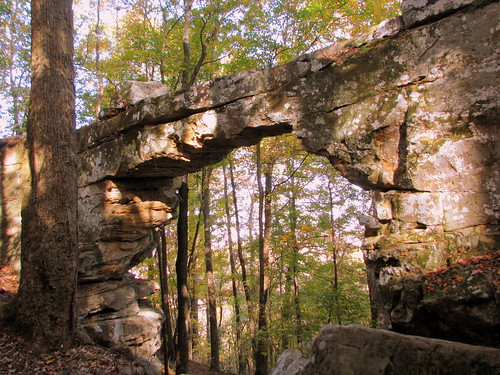
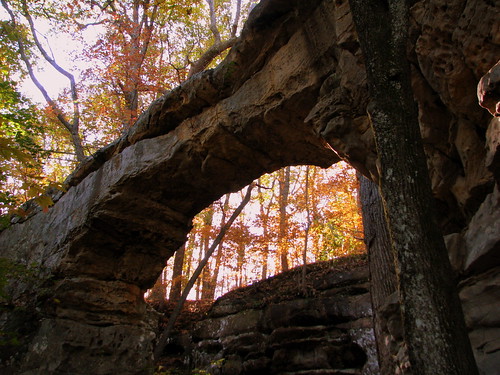
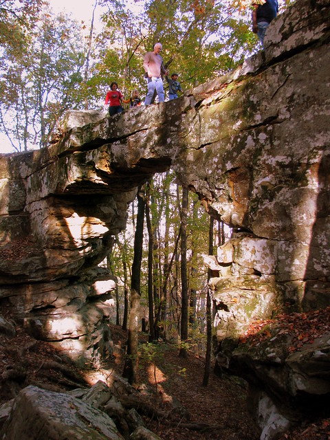
Sewanee Natural Bridge in Franklin County, Tennessee, is a 25 feet (8 m) high natural sandstone arch with a span of 50 feet (15 m). It is essentially a giant sinkhole partially eroded to form a large stone bridge. A wet weather spring located behind the bridge in a rock cave probably contributed to the erosion forming the arch. It is called the Sewanee Natural Bridge as it was once owned by the University of the South in Sewanee, Tennessee. It is a 3 acre (12,000 m²) designated state natural area.

Today, the Area is considered part of the South Cumberland State Park. You can't get to the bottom if you are afraid of heights as you have to walk over the bridge, which is about 3 ft. wide, to get to the other side where you can scale down it. To get here, you'd follow the signs iff highway TN56.

Monday, August 22, 2011

Sewanee Natural Bridge

Sewanee Natural Bridge

From Wikipedia:
Sewanee Natural Bridge in Franklin County, Tennessee, is a 25 feet (8 m) high natural sandstone arch with a span of 50 feet (15 m). It is essentially a giant sinkhole partially eroded to form a large stone bridge. A wet weather spring located behind the bridge in a rock cave probably contributed to the erosion forming the arch. It is called the Sewanee Natural Bridge as it was once owned by the University of the South in Sewanee, Tennessee. It is a 3 acre (12,000 m²) designated state natural area.

Today, the Area is considered part of the South Cumberland State Park. You can't get to the bottom if you are afraid of heights as you have to walk over the bridge, which is about 3 ft. wide, to get to the other side where you can scale down it. To get here, you'd follow the signs off highway TN56.

Wednesday, June 22, 2011

A Tennessee Swimming Hole

A Tennessee Swimming Hole

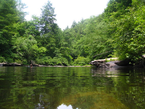
This hidden-in-the-woods place is "Blue Hole" it is upstream from Greeter Falls in its segment of the South Cumberland State Park. It's located near the town of Altamont, TN in Grundy County just off of highway TN 56. The trail to get here is about .6 miles from the parking area. My wife and I were tempted to stay the whole day.

Thursday, December 23, 2010

Sewanee Natural Bridge

Sewanee Natural Bridge

From Wikipedia:

Sewanee Natural Bridge in Franklin County, Tennessee, is a 25 feet (8 m) high natural sandstone arch with a span of 50 feet (15 m). It is essentially a giant sinkhole partially eroded to form a large stone bridge. A wet weather spring located behind the bridge in a rock cave probably contributed to the erosion forming the arch. It is called the Sewanee Natural Bridge as it was once owned by the University of the South in Sewanee, Tennessee. It is a 3 acre (12,000 m²) designated state natural area.

Today, the Area is considered part of the South Cumberland State Park. You can't get to the bottom if you are afraid of heights as you have to walk over the bridge, which is about 3 ft. wide, to get to the other side where you can scale down it. To get here, you'd follow the signs iff highway TN56.