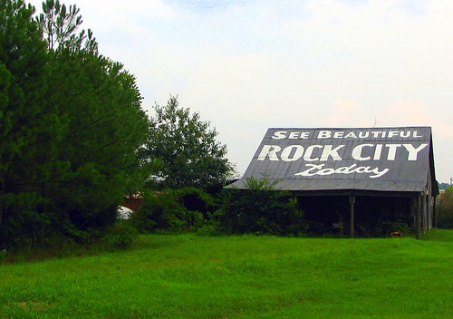
See Beautiful Rock City
Near Chattanooga, Tenn.
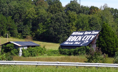
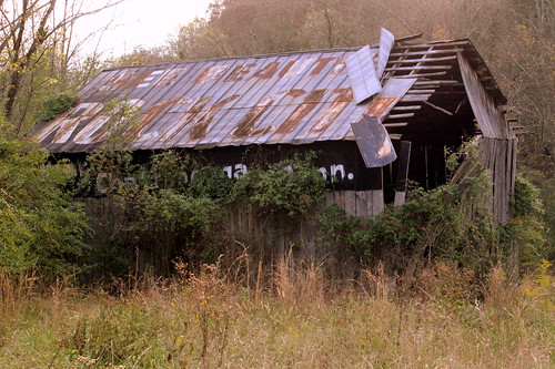
Here is a tough to get to Rock City Barn that is not recommended, but there's no other real way to go see it. This barn is located off of Interstate 40 at exit 356. Specifically, for the people in Roane County travelling northbound on TN326 / TN58, this barn is located just off of the eastbound on-ramp to I-40. When I first learned of this barn several years ago, I took that on-ramp only to find that you can just barely see the barn through the trees.
On this particular day near the end of fall after the leaves have fallen off, it's a little bit easier to see, but not really. I parked on the shoulder of the on-ramp to try to get a closer look on foot. As it turns out, there was a well-established path through the overgrowth to get a closer look. (I had no idea there were so many of us wanting to photograph this barn!) At the time, the entire property looked desolate with no signs of anyone living there and a for sale sign in front of the house. If I thought someone actively lived here, I wouldn't have tried it and would have sat in the car pouting like my previous occasion where I tried to see it through the trees.
This barn has a bonus challenge for anyone reading this who might be extra daring. The other side is also painted with the message "See Rock City Today." I wasn't particularly keen on weed-whacking to get to the other side, but maybe you'd like to try it. To me, the weird thing is I'm not sure how many people have ever seen the other side. The line of trees makes it virtually impossible today. With the angle of the barn, it would have been awfully difficult to see from the westbound traffic on I-40 or the on-ramp with your head turned around.
See it on a google map here:
goo.gl/maps/dYx17
This is now one of
83 different Rock City Barns I have photographed and uploaded to Flickr in my
Rock City Barns set. People often ask me how I've found so many of them. I have drawn from many resources such as books and web sites and sometimes luck, but there's not really one "go to" place to find them all. Well, now on my website, I have tried to create a one stop source for the locations of all of the barns I've been to. On my
Map of Rock City Barns page,
I have plotted each barn on a Google Map.